Hello, I am trying to load a custom map in Mission Planner,
I have read the two main topics on the subject (just below) and I am facing issues.
Custom Imagery in Mission Planner
Custom Maps in Mission Planner
When I use Global Mapper, I am able to load tiles from geotiff files as shown in M. Oborne tutorial, it works well with the default zoom proposed by the software, however, when I want to export with x20 zoom for Mission Planner, Global Mapper can’t manage to export the file (it is not so important, but good to notice).
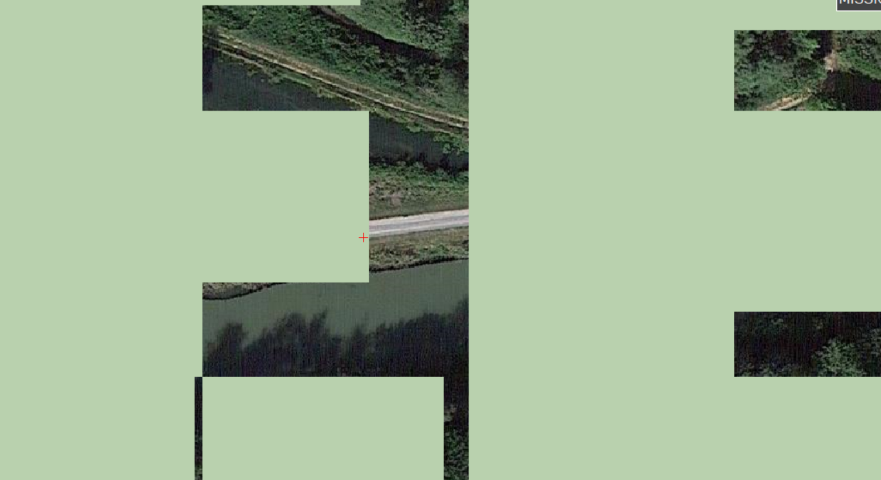
When I try to load a custom map using GDAL, I have superposition issues between the maps I just loaded and the default map:
I know that Mission Planner uses the WGS84 standard, I only use downloaded geotiff file from sources I found on the forum, so I don’t know if geotiff files use this standard and if the issue is linked to this.
Is anybody able to identify the problem ? Could someone provide me with a custom map which is well suited for MissionPlanner to try with “Custom GDAL” and see if it comes from my downloaded maps ?
It tried with geotiff of over 1 GB size, but some seems not to be loaded at all, is there a limit to the .tif size MissionPlanner accepts ?
I could use tiles but I can’t purchase Global Mapper for the moment. If someone has a tutorial to export tiles from a free software to use then “Inject GE”, it may be a solution.
Sorry for my english and thank you in advance
loupdmer