@ArduNoob. Re read the Docs on basic rover setup.
done the speed tuning and I have controlled the auto mission speed via waypoint speed parameter. the max throttle is still 100% but when auto mode is engaged it slows down to the waypoint speed setting. thank you for explaining. Also I’ve engaged the brake function which randy said creates the rover to slow down slightly to get a better turn radius. not sure if its helped much as the turn radius on my rover is really bad
Sounds like progress! It’s important to input the turn radius of your vehicle also. Measure the tightest it will turn and enter that value.
I wanted to do some more driving today so I sat inside and navigated from my 2nd floor office window. From multirotor experience the RC control range of these Frsky 915mhz systems is impressive even at the 10mw level I had it set for. It will go to 1W! And yes, I have an amateur radio license 
2 Likes
Calling out to all the fellas @dkemxr @David_Boulanger @iampete @count74 @ktrussell
Regarding GPS Blending (aka Dual GPS)
http://ardupilot.org/rover/docs/common-gps-blending.html
Would like to hear all your views on this method and if it would increase accuracy for GPS positioning and Auto Missions. Buying another identical GPS module will cost me £36.99. Buying the Here+ V2 GPS RTK GNSS will cost me £549.99.
Would you all say that buying another identical GPS Module to the one I have and blending will give better results or would it not make much of a difference? I’m intrigued to hear your thoughts and if anyone is familiar with this method or have actually tried it. Thanks in advance👍🏼
might improve accuracy slightly but its more to catch gps glitches and improve reliability.
Google Earth images will always be inaccuratly placed (up to ten meters, according to some sources), so no matter how accurate your meassured GPS position is, it will never show up at the correct spot in Google Earth. Getting accurate maps/aerial photos of an area is a complicated process, mostly done for construction and other professional needs.
So investing in a RTK GNSS unit will not solve the problem between GPS position and placement of the Google Earth images.
So that could mean the rover is pretty accurate already but due to the slight shift in position on the google earth map it seems off. So once you can calculate the offset on the map that might lead to a more accurate auto mission? Is that possible?
I also tried QGroundControl last night but the map quality isn’t great and the zoom is nowhere near as close as MP. Nice interface and clean to use but mission planner maps are far better
You can change the map provider in Qgroundcontrol and Missionplanner. I am not at my PC, but in Qgroundcontrol it is in the settings and in Missionplanner it is in the planning window, as far as I remember. That way you can compare which one gives better results.
Google Earth uses photos from many different sources for different areas and zoom. If you calculate the offset for one area it might be different in another. But if you use your rover in the same location, it might be worth a try.
I tried it on a mid-size multirotor only because I had extra modules lying around. I noticed no improvement in accuracy. Maybe some redundancy as Peter suggested.
I’m not sure if it suits your needs but you can enable a Save Waypoint option on a switch and drive the vehicle around saving Waypoints as you go by flipping the switch.
Regarding changing maps in mission planner I did try that but most of them aren’t showing real terrain and no way near the quality of google earth. I’m sure I will figure it out & find the right map for my garden to start with.
It’s just a shame that the map accuracy is off (up to 10 meters) as you mentioned which is really bad for plotting accurate auto missions & on the ground if using a rover like myself. I guess in the air it’s not a major problem but on the ground with obstacles like bushes, trees etc accuracy is needed.
@dkemxr
Regarding saving a waypoint option via a switch on the transmitter. I’m guessing you set the option, drive the rover to 4 points of the garden & at each point you flip the switch to save the waypoint. Then upload the mission back into MP & make any edits required then re-write the mission back into the pix. Is that how it works?
Also if that’s how it works that’s a brilliant way of seeing how MP maps see the waypoints after the rover has done a tour around the garden. This sounds more logical in order to calculate how far off the maps on MP are against the real thing
Yes, that’s how you use Save Waypoint. I used this on my 1st Rover to navigate between some relatively tight spots around my house. Just keep in mind you will still be at the mercy of the basic accuracy (HDOP) of the GPS so you can still expect some non-repeatability run to run. But depending on how close you navigate to obstacles it might work for you.
Thank for letting me know about this. So this is in the basic tuning page where you can drop down the tab with what channel 7 does & instead of Arm/Disarm you can select Save waypoint.
I think this will be they key to a more accurate auto mission. Might not be dead on accurate but still an improvement. I’ve also ordered a second gps module which I will try blending for some improvement even if it’s only slight it’s better than nothing.
Wanted to ask with gps blending, does only 1 gps work at 1 moment or are both combined & simultaneously working together? For example if 1 gps picks up 10 satellites & the other 5 does it combine data from both gps modules to then have 15 satellites working together?
Right, but you don’t have to lose the Arm/Disarm switch just setup another switch.
Here is some info on Blending.
Thank you I will look into this. From what I’ve understood it used either one or the other gps module but not both simultaneously. Regarding positioning of the external gps would it help to have one at the front of the rover and one at the rear or both in the same position side by side would be better?
Also I’ve seen that you can download the maps on MP called Prefetch. Would doing this help in providing a more accurate map reading or would it be the same as doing it live using internet?
I would space them out if you could but in practical terms some cm’s will probably make no difference.
Pre-fetch is the same info, that won’t help you.
ok thanks for the heads up on spacing the gps
& also on the map in mp. I think with the save waypoint feature you’ve mentioned it will definitely be something that will help in understanding the way MP maps works in comparison to the real layout of my garden.
I think that’s a big determining factor in making a more accurate mission.
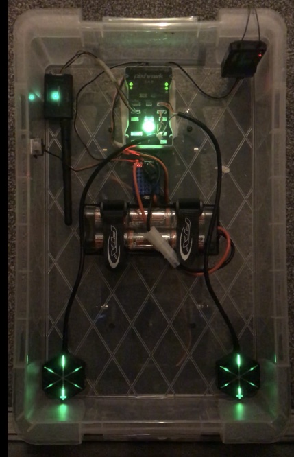
Managed to hook up the second gps module last night & followed the instructions in the GPS Blending tutorial. I noticed the rover is pointing in the same direction much more accurately & in a better position even when inside the house.
What is DGPS as that’s what comes up in the HUD now after I attached the 2nd GPS module? It usually says 3D Fix but now it’s changed to DGPS.
HDOP Shows around 0.80 and when I view Satellite 1 info it Shows 13 and Satellite 2 shows 18 so I’m assuming both are being detected as the info is different. But not sure how to know 100% that it’s working
These are the settings I used:
- SERIAL4_PROTOCOL = 5 (replace the “4” with “1” or “2” if the 2nd GPS is connected to Telem1 or 2)
- GPS_TYPE2 = 1 (to enable automatic detection of the 2nd GPS)
- GPS_AUTO_SWITCH = 2 (to enable Blending) or 1 to use the existing logic which uses only one GPS at a time
I tried the save waypoint feature but it wasn’t working. I didn’t put it on a separate switch so maybe that’s why it didn’t work
Dual GPS i think, looks like your getting the hang off it.
1 Like
Thank you, slowly but surely ile have this all sorted.
I’ve read that when detected satellites are above a certain number MP switches from GPS to DGPS. Maybe if I buy 2 more gps modules it could magically turn into RTK😂
Is it possible to add one more gps module if I wanted to and run it through the telemetry port? Right now I have 1 connected to GPS Port & the other on Serial 4/5 port.
On MP there are options to use 3 compasses. I don’t think the additional GPS I’ve recently added goes through the compass settings page as I still only have compass 1 ticked & selected as Primary Compass. The other two boxes on the right for compass 2 & 3 are unticked. So does the external bypass these options?
I think there is a max of two.
External compasses show up first and internal ones get bumped off the list. I think you will have to wire it up to a i2c port tho. I gps one connector has uart for the gps and i2c for the compass on the one connector. the other gps/telm ports are just uart.