Hi all,
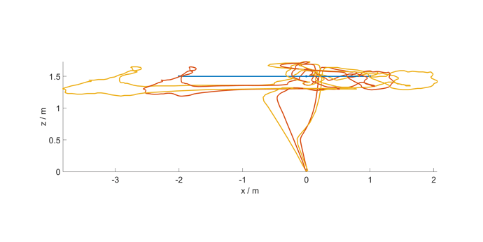
I realized a flight with a fake-GPS system instead of the standard GPS. I basically used the message @tiffo described here. Now, that I’m evaluating the flight data I came across something which I don’t understand. I plotted the desired flight path (blue) against the real flight path from my external navigation system (red), and also the GPS information that Ardupilot logs as raw GPS data. See the plot here
I thought that the real position (red) and Ardupilots GPS-position (yellow) match. (I calculated the distance in meters from the Haversine formula.) Do you have any idea why there is this difference? How are the logged raw GPS data recalculated? Can this be due to some EKF behaviour?
Thanks,
Fabian
