Alex,
I doubt it’s related to resolution. I had great results with 2.5cm/pix. File coordinates are crucial.
Dave
Alex,
I doubt it’s related to resolution. I had great results with 2.5cm/pix. File coordinates are crucial.
Dave
Good to hear. I assume you referred to the YouTube video for the original setup? I might need to update it to reflect the moved folder.
Aloha!
I am attempting to load in custom elevation data into Mission Planner so that I can have a better precision than the 100m google earth data. I loaded a 10 m DEM into Global Mapper, following your video tutorial and placing the derived GeoTIFF into the SRTM folder (and removing the other files). When I do this the upper right corner in mission planner says ‘invalid’ and all elevation data is 0. I made sure the DEM was wgs84 beforehand as well. Any ideas on what went wrong?
check missionplanner.log in c:\programdata\mission planner
this should list details about the attempt to load the file
Hey,
I’m trying to make a terrain following flight with my DTM custom map.
I have followed all the stages that you wrote here.
And it still doesn’t fly 40 meters above the terrain data from the geotiff,
The weird thing is that it doesn’t fly 40 meters above the SRTM data either.
it flies something between with no constancy.
When I flew there with the SRTM data (before inserting the Geotiff), it flew successfully 40 meters above SRTM terrain data.
If someone knows how to help me it will be great. I’m pretty stuck with the subject.
Thanks
Hi Michael,
Does this internal limit still exist with current versions of mission planner?
I was able to import custom imagery into mission planner my export settings are as follows;
This was done using global mapper. If you could please recommend a software that could provide a higher number of zoom levels.
Thanks
The internal zoom limit would be 21 or 22. Anything above this will not be used
Thank you, Michael.
You have a great day ahead.
Hey Michael,
While I have your attention, is it possible to insert more than one custom map in mission planner? I wish to have max 3 atleast 2 custom maps in mission planner that show the following;
1 - google map tiles custom map.
2 - a DEM in a google map tiles format.
Thanks.
do you know if your DEM format is supported by gdal?
MP handles imagery and DEM seperately.
Normal the DEM would be in GeoTiff format, and only requires copying the source image into the correct folder to work.
The DEM which is in geotiff format is copied to the SRTM directory. How do I find out if my DEM format is supported by gdal? I wish to have the ability to display both the google map tiles of a surveyed area and the DEM file to the pilot using mission planner to plan a mission.
Thanks.
Hi Michael,
I can confirm that my DEM which is in the format of geotiff is supported by gdal.
Thanks.
check this post
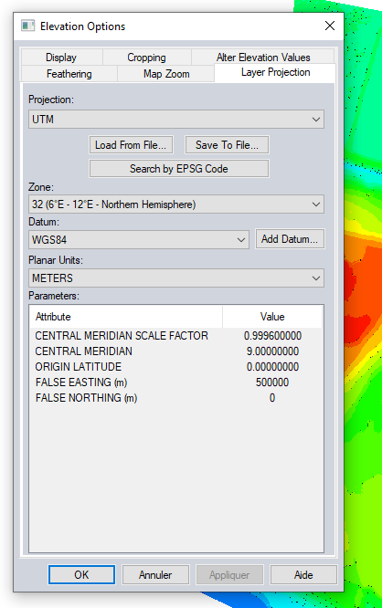
your image is not in wgs84.
looks like its in some other coord system
change the projection to Geographic
It works well ! Thanks 
Just a quick note:
The version of libtiff being used does not like:
Best bet seems to be to stick with ultra-vanilla Non-tiled, strip-encoded, LZW-compressed imagery.
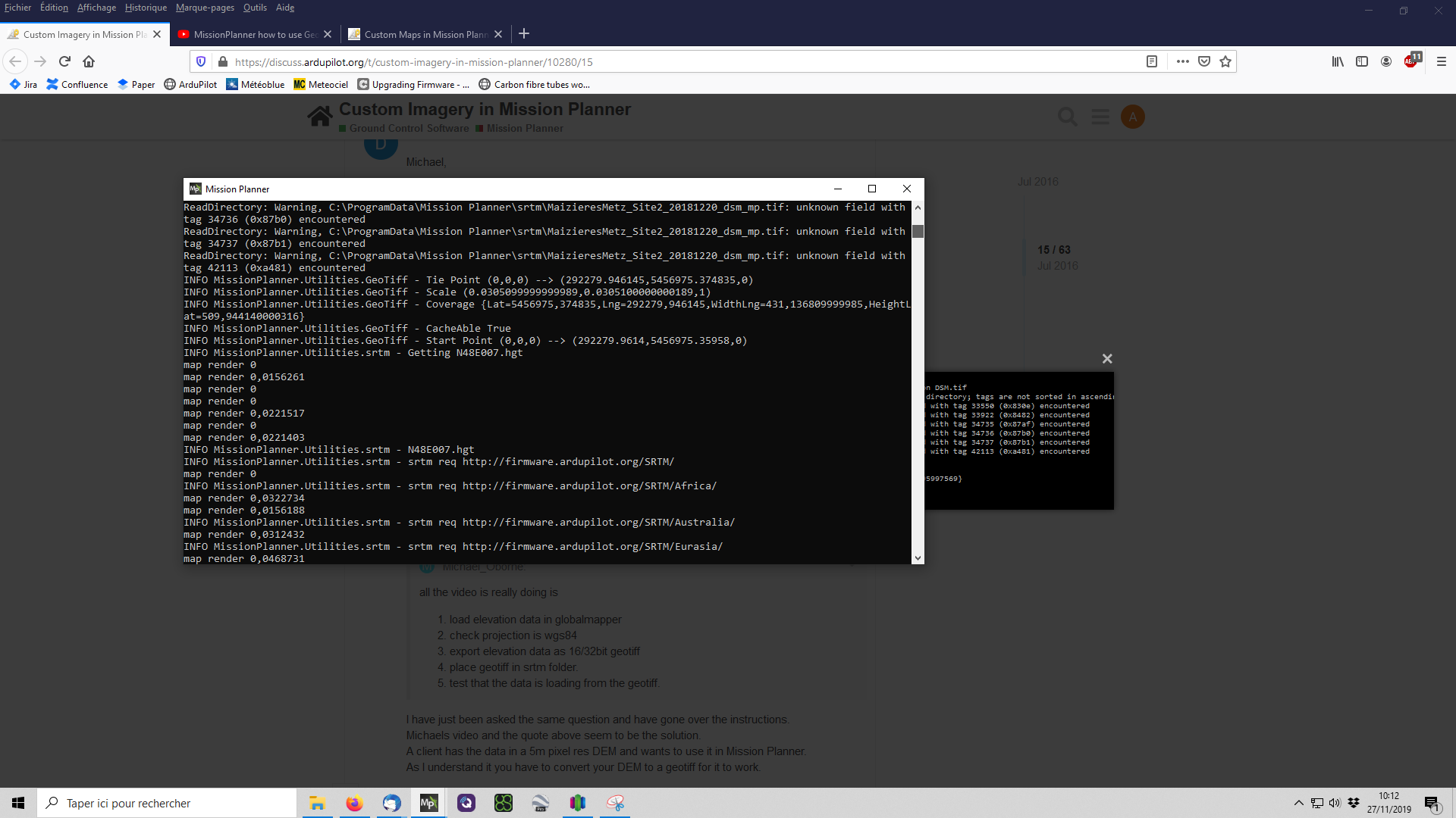
Hello thre, I have tried to get my geotiff file to be accepted in the latest mission planner.
It seems to load, but there is no altitude data.
From debug:
INFO MissionPlanner.Utilities.GeoTiff - GeoTiff C:\ProgramData\Mission Planner\srtm\2.tif
ReadDirectory: Warning, C:\ProgramData\Mission Planner\srtm\2.tif: invalid TIFF directory; tags are not sorted in ascending order
ReadDirectory: Warning, C:\ProgramData\Mission Planner\srtm\2.tif: unknown field with tag 33550 (0x830e) encountered
ReadDirectory: Warning, C:\ProgramData\Mission Planner\srtm\2.tif: unknown field with tag 33922 (0x8482) encountered
ReadDirectory: Warning, C:\ProgramData\Mission Planner\srtm\2.tif: unknown field with tag 34735 (0x87af) encountered
ReadDirectory: Warning, C:\ProgramData\Mission Planner\srtm\2.tif: unknown field with tag 34736 (0x87b0) encountered
ReadDirectory: Warning, C:\ProgramData\Mission Planner\srtm\2.tif: unknown field with tag 34737 (0x87b1) encountered
ReadDirectory: Warning, C:\ProgramData\Mission Planner\srtm\2.tif: unknown field with tag 42113 (0xa481) encountered
INFO MissionPlanner.Utilities.GeoTiff - GeoKeyDirectoryTag ID=GTModelTypeGeoKey TagLoc=0 Count=1 Value/offset=2
INFO MissionPlanner.Utilities.GeoTiff - GeoKeyDirectoryTag ID=GTRasterTypeGeoKey TagLoc=0 Count=1 Value/offset=2
INFO MissionPlanner.Utilities.GeoTiff - GeoKeyDirectoryTag ID=GTCitationGeoKey TagLoc=34737 Count=13 Value/offset=0
INFO MissionPlanner.Utilities.GeoTiff - GeoKeyDirectoryTag ID=GTCitationGeoKey Value=GCS_WGS_1984|
INFO MissionPlanner.Utilities.GeoTiff - GeoKeyDirectoryTag ID=GeographicTypeGeoKey TagLoc=0 Count=1 Value/offset=4326
INFO MissionPlanner.Utilities.GeoTiff - GeoKeyDirectoryTag ID=GeogAngularUnitsGeoKey TagLoc=0 Count=1 Value/offset=9102
INFO MissionPlanner.Utilities.GeoTiff - GeoKeyDirectoryTag ID=GeogEllipsoidGeoKey TagLoc=0 Count=1 Value/offset=7030
INFO MissionPlanner.Utilities.GeoTiff - GeoKeyDirectoryTag ID=GeogSemiMajorAxisGeoKey TagLoc=34736 Count=1 Value/offset=0
INFO MissionPlanner.Utilities.GeoTiff - GeoKeyDirectoryTag ID=GeogSemiMinorAxisGeoKey TagLoc=34736 Count=1 Value/offset=1
INFO MissionPlanner.Utilities.GeoTiff - GeoKeyDirectoryTag ID=GeogInvFlatteningGeoKey TagLoc=34736 Count=1 Value/offset=2
INFO MissionPlanner.Utilities.GeoTiff - GeoKeyDirectoryTag ID=VerticalUnitsGeoKey TagLoc=0 Count=1 Value/offset=9001
INFO MissionPlanner.Utilities.GeoTiff - GeoAsciiParamsTag GCS_WGS_1984|
INFO MissionPlanner.Utilities.GeoTiff - Tie Point (0,0,0) → (9.2415303599874,62.2202885638702,0)
INFO MissionPlanner.Utilities.GeoTiff - Scale (8.97327984480212E-05,8.97327984480212E-05,1)
INFO MissionPlanner.Utilities.GeoTiff - Coverage {Lat=62,2202885638702,Lng=9,2415303599874,WidthLng=3,97067633132494,HeightLat=2,3441796266561}
INFO MissionPlanner.Utilities.GeoTiff - CacheAble False
INFO MissionPlanner.Utilities.GeoTiff - Start Point (0,0,0) → (9.24157522638663,62.2202436974709,0)
ReadDirectory: Warning, C:\ProgramData\Mission Planner\srtm\2.tif: invalid TIFF directory; tags are not sorted in ascending order
ReadDirectory: Warning, C:\ProgramData\Mission Planner\srtm\2.tif: unknown field with tag 33550 (0x830e) encountered
ReadDirectory: Warning, C:\ProgramData\Mission Planner\srtm\2.tif: unknown field with tag 33922 (0x8482) encountered
ReadDirectory: Warning, C:\ProgramData\Mission Planner\srtm\2.tif: unknown field with tag 34735 (0x87af) encountered
ReadDirectory: Warning, C:\ProgramData\Mission Planner\srtm\2.tif: unknown field with tag 34736 (0x87b0) encountered
File:
https://drive.google.com/u/0/uc?id=1e9t_Du2tnUDcuIj7Pm1Zpfs3qI0LF6Aa&export=download
That files is converted by a friendly person, since I do not have access to Globalmapper.
Related: