Hello everyone ,
Please Does anyone knows how to visualize the pixhawk cube on the map as an airplane , I tried it following some tuto but till now it didn t work .
Thank you in advance for your help .
Hello everyone ,
Please Does anyone knows how to visualize the pixhawk cube on the map as an airplane , I tried it following some tuto but till now it didn t work .
Thank you in advance for your help .
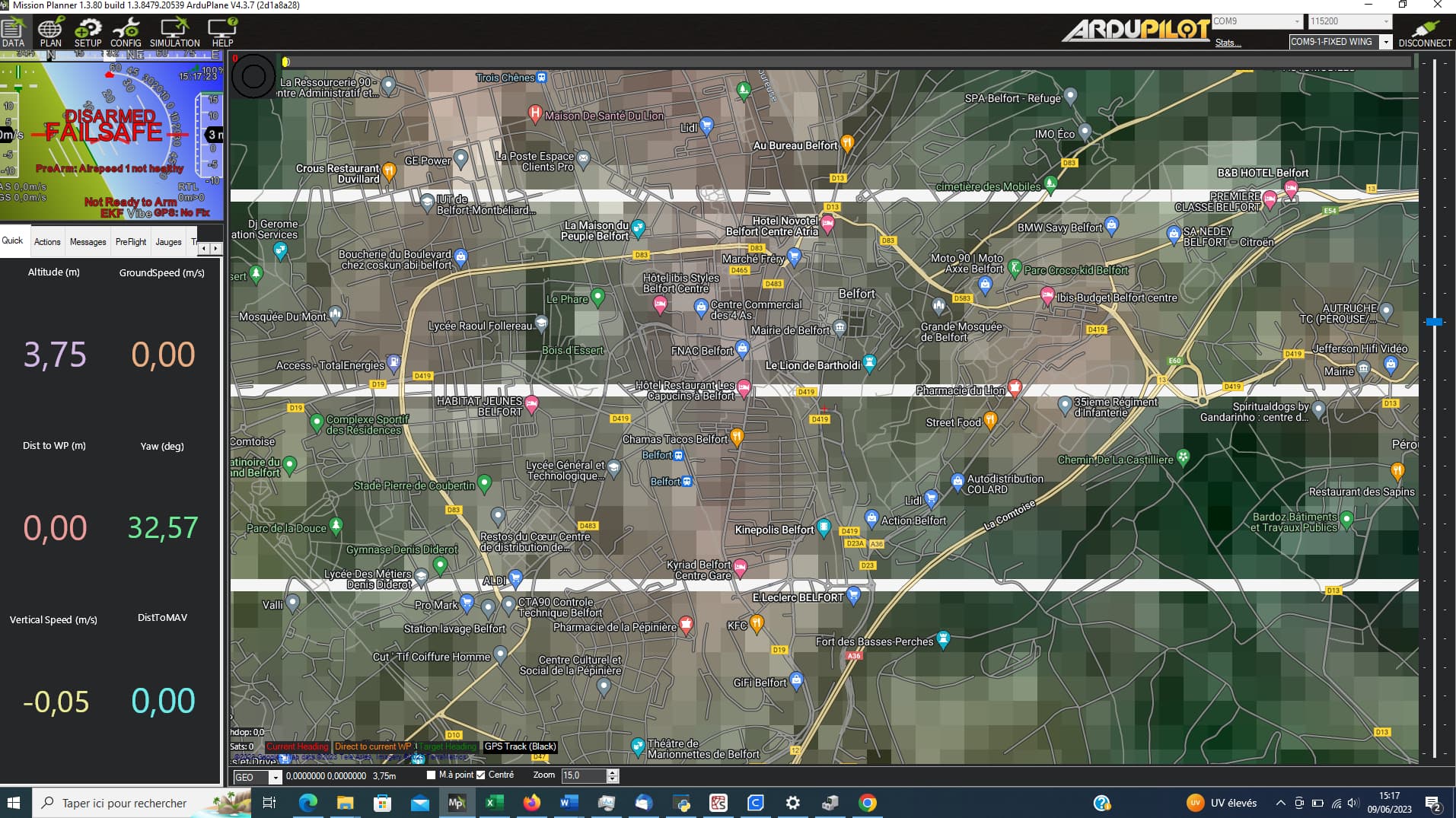
How would it show up on the map with “GPS:No fix”?
And don’t double post.
How could I fix It ?
I posted twice because maybe there is people who could understand changing the topic
Hint:
“How would it show up on the map with “GPS:No fix”?”
So, you need a GPS fix…
I already have a GPS fix with green yellow LED
Clearly you do not. From your own screen shot.

if there is something to modify on mission planner what is it then ? because I can show you the picture of my pixhawk cube and GPS with the yellow led if you want ?
and thank you if you are gonna help
No. Click the messages tab and see what it says.
It happened for other people as you can see here : GPS:No Fix....but there is a fix shown? (SOLVED by updating MIssion Planner to latest) - #11 by RogerR
ps : ADSB_ ENABLe doesn t exist in my config
Then try that fix. From the Help Tab click the button “Check for BETA updates”
Not sure what GPS you’re using, but if it’s taking its notification cues from ArduPilot, yellow usually means failed prearm checks…probably because you have no fix.
I did it still not working
Exactly , I and am still stuck and checking for a solution , because I found that there is a differece between NO FIX and NO GPS , actually The data knows that there is GPS but no fix
Are you testing outdoors?
Bench testing GPS indoors often produces this result.
Could you explain what it means plz
Go outside when you want to use GPS.
In the Quick View panel double click the Yaw value and replace Yaw with “satcount”. Then see what it says.
And realize you posted in ArduCopter and you have Plane firmware installed.