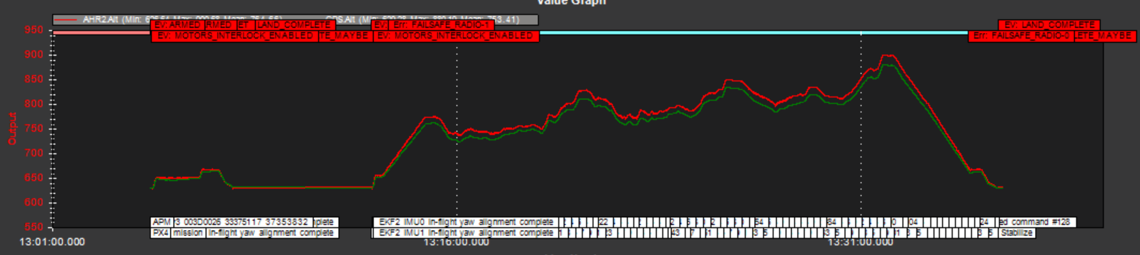
Over a flight of about 20 minutes I notice a scaling issue between my AHR2 and GPS altitudes. Just wondering if anyone might know how to remedy this. I believe it is causing an issue where my hex flies consistently ~15m below the elevation defined by my waypoints.
(AHR2 in green, GPS in red)
Logs:
https://drive.google.com/drive/folders/1Jjr1ATOS_O-6VmAC_03GMkVM03dJqye9?usp=sharing