Just that.
MP 1.3.77 dont work with DEM data (geotif) in srtm folder
1.3.74 works fine
1.3.75 dont work
1.3.76 i dont try yet
Any advice for 1.3.77 work ?
Just that.
MP 1.3.77 dont work with DEM data (geotif) in srtm folder
1.3.74 works fine
1.3.75 dont work
1.3.76 i dont try yet
Any advice for 1.3.77 work ?
do you have a sample file that not working?
Thanks MIchael,
Here are link:
https://drive.google.com/drive/folders/1JW9l1-OdTIRT5LNSa7ceRaBFgNDxIMIk?usp=sharing
You can find 4 files:
1 02 Chili.waypoints // i think simplest way to find place when you load dem (chilicocha)
chilicocha_dem_2m_16bits_lzw.tif // dem data in 16 bits and compressed
chillicocha_dem_2m.tif // standar dem data as always load in srtm folder
Yangafu_3_2m.tif // just another example in standar format
can you please try the latest beta?
Hi Michael,
Thanks for your amazing work.
With beta update ( 1.3.865) custom DEM data loaded in srtm folder works again,
just take note:
waypoints numbers are not showed when open the elevation profile tool as in previous versions (this feature is very usefull)
Thanks again, i have few feedback to you:
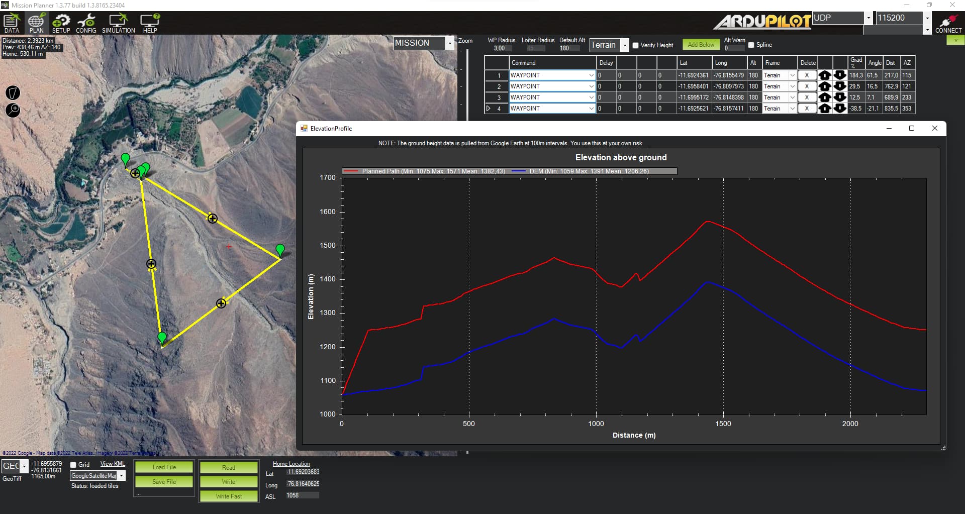
In previous versions of mission planner it was possible to simultaneously see the google dem and the custom dem loaded in the corresponding folder.
For some time now, when loading a geotif, the default profile is no longer visible.
Is there a way to activate that function and see both?
Likewise, when reviewing the flight log, the function TERR → terrH only shows the google profile and does not show the custom one
What do you think?
its very usefull for analisis too, like can be in this (sad) case:
Cheers
google dem was dropped because someone abused the service, and i got a 4000USD bill. and it wont be returning.
how is this possible ??? amazing… sorry for hear that