Thanks  I’ll look into this later. Your process would become far easier as soon as we get mapbox support in QGC and MP: Reefmaster does not need the map picture input at all. Just draw a polygon for shoreline and islands (use GE), import as shoreline/islands in RM, then import tracks or CSV captured depth info. Export result to KMZ and import as tileset in mapbox studio. The finally add the layer to a mapbox style of your choice. I use a plain satellite style with no added info to ensure that my style does not get cluttered
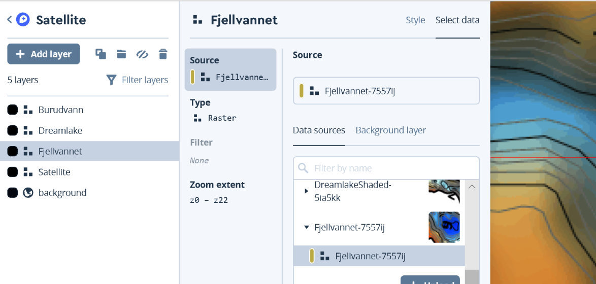
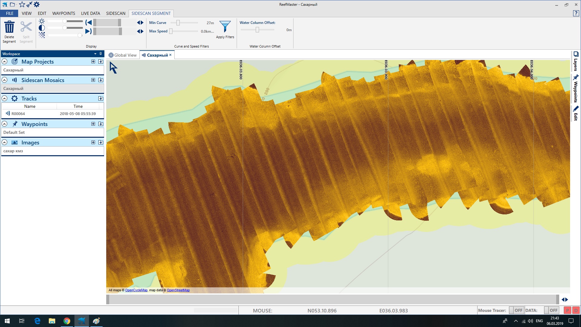
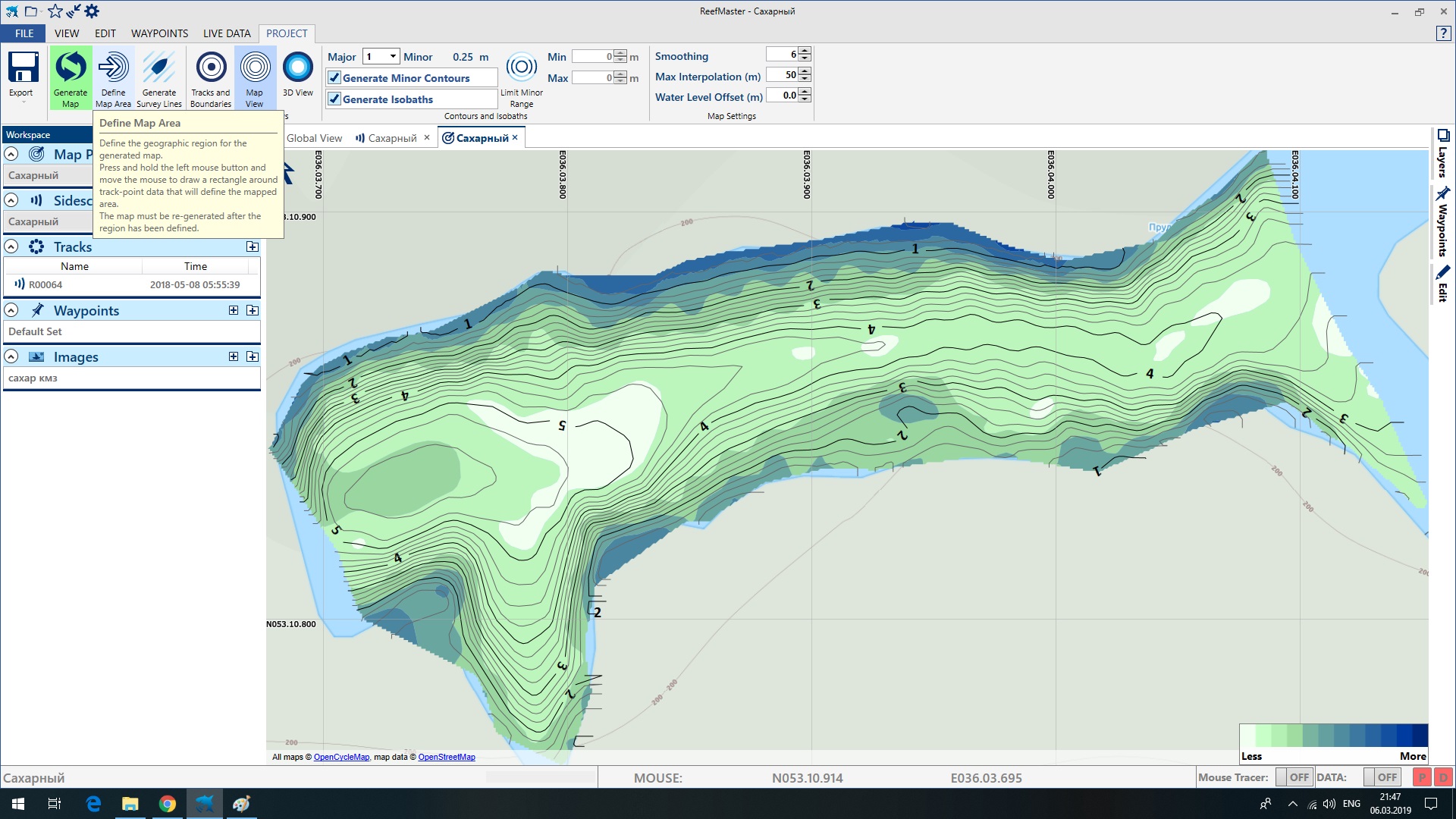
Well Olav in my place Map box satellite view is very poor. So adding sat pic in Reefmaster is a necessity. Check this out https://api.mapbox.com/styles/v1/plastic11/cjs1tc96a00uf1fo3s4bqcnpi.html?fresh=true&title=true&access_token=pk.eyJ1IjoicGxhc3RpYzExIiwiYSI6ImNqczQ2cDRlMzAxcHo0M3BmbWNxemQ3ZHIifQ.f8VqUsBLnI4qVAr2Nj0cXg#16.42/52.894853/35.752481
OMG! Was not aware that images could be that lousy, understand why you need to do the extra work.
You could of course base the style on a terrain or street map. I have that as well. I don’t like it that much since the shorelines of waters typically are inaccurate. But I have it ready anyway, never wrong to have alternatives 
Actually, I tested QGC with that alternative (swapped the style Id). That’s how I noticed that QGC was not very keen to download tiles but rather use the cache.
It might be a better solution to define styled Mapbox Maps as a new map provider, and to retrieve the available styles with an API (it is there, I’ve tested it) and then to populate the map type drop down with the available styles. That should trigger QGC to download new styles (QGC does that when you change from sattelite to streets for the same map provider, so this is probably the ultimate solution…). But I think what I’ve done now is a good start…
I`ve changed to street view https://api.mapbox.com/styles/v1/plastic11/cjs7ptz9n3n791fqbgj77j2yd.html?fresh=true&title=true&access_token=pk.eyJ1IjoicGxhc3RpYzExIiwiYSI6ImNqczQ2cDRlMzAxcHo0M3BmbWNxemQ3ZHIifQ.f8VqUsBLnI4qVAr2Nj0cXg#15.22/52.893523/35.745533
1 Like
Ha ha  Sorry, but that is probably the worst I’ve seen. Totally useless. Your solution to utilize images is an absolute necessity. Compared with your situation, complaints when a waterline is misplaced by 5-10 meters in a corner seems downright silly…
Hi Andrei,
I see you have a similar setup for lowrance nmea output as I’m trying to do.
Maybe you can take a look into my last post PixHawk3 and echosounder with NMEA output
Your comments will be very valuable. Thank youvery much.
Finally: I have a modified QGC as an APK app running on a tablet and a phone. I usually love Windows. But building for Android in QT on Windows was nothing less than a nightmare. After a long day of work I have dual boot with Ubuntu. I hated the setup of QT etc in a totally alien OS. But once finally achieved it, the Android build was easy.
Now to upcoming ambitions:
@rmackay9 @Plastic I will try to make a pull request to start the process for getting styled mapbox map into mainstream QGC. Not exactly sure of the detailed process, but I’ll figure it out.
However: I think the solution should be altered so that styled maps are a new “map provider”, where you only enter the mapbox account name. Then retrieve names and IDs of the defined styles and populate the map type drop down with the result. I’ve testet the API for that. Solution will be much better. Ran through a C++ tutorial during my winter vacation now, it’s achievable Not sure if the main architects behind QGC agrees, though…
Also as a secondary effort: For QGC I would like to add a simple graph to view the depth profile in the GUI. The typical HUD is not particularly useful for boats IMO. QGC supports QT Charts, I guess a line chart could be used to visually draw the bottom contour (ambition does not include scatter data, just the depth profile in m/ft displayed as a line).
@rmackay9 I’d love to view the transducer’s reported temperature in the GUI as well. Possible to adjust the ardurover firmware to supply this?
1 Like
Congratulation Olav. You`re simply the best. Can you share the apk?
That’s too kind. But thanks
Of course I can share the current version: You may find the APK here. Do share experiences and opinions - I still have not come around to make a pull request and I am happy to make adjustments before I do.
A note: I built the APK for SDK 19 (Android 4.4 KitKat). Installed successfully on a Huawei tablet (MediaPad M5 10’’) and a Samsung Galaxy S9. An installation on a Samsung Galaxy S7 failed for unknown reasons. I do not guarantee that you will get this to work.
Also: APK file named “android-build-release-signed”. But it is still QGC app with QGC icons. Maybe it makes a mess if you have release and/or daily build of QGC already installed. I removed my existing apps upfront to avoid issues.
And one usability thing that you may have noticed already: Mapbox is not available as map provider until you enter the Mapbox token. And even then Mapbox is not available before you close the app and restarts it.
@oaamaas, nicely done!
I’ll try and add the temperature to the NMEA sonar driver (for ECT400, etc). I can’t promise exactly when but I’ll try…
1 Like
Thank you Olav. Just tested on Samsung Tab s3, everything works just fine. I removed existing apps too. Was a little bit confused about map box style, but after some tests i figured out that it must be something like this _cjs7ptz9n3n791fqbgj77j2yd_but not the way i named it in mapstudio. Wish there was a way to change Map box style ID and have some styles at the same time. For example one for classic depth map, another for side imaging map, bottom hardness map etc. It`s a great improvement for lake mapping.
1 Like
The solution is not perfect. Style has a name and an ID (and some additional attributes as well). The ID is the latter part of the mapbox style url (everything after the last forward slash).
Better solution:
- add mapbox custom (or something) as a new “map provider”
- in settings, add just the account name and button to retrieve styles
- when button pressed, all styles are retrieved (API for that exists, I have successfully tested it)
- the result is an array of all styles for the user, including both name and ID of each style.
- this result then used to populate drop down for “map type” for this new “map provider”
This would provide a much better user experience. But when I started to look into the code concerning selection of map provider and the map types: I realized that the current code is well thought out, and that maps are critical to the use of QGC. So this is something that you do not want to mess up. I like to do this, but being inexperienced and not yet fully understand the current code: This is going to take some time. And the core developers are likely to have strong opinions on changes.
Now: In mapbox studio, you can only have one visible tileset for a given area (water). I would suggest to create multiple styles and have one for sidescans, one for depth curves and so on. Give the styles a descriptive name. Then switch the style in QGC to provide different views. Now you see, my ambition to populate the drop down with the style names make perfect sense. The name you can alter, the ID is however generated by Mapbox and is not editable.
I’ve almost figured out how to make a pull request (the changes are already pushed to my personal branch in GIT). I could complete it in 5 minutes. Now I must decide if I should suggest my simple solution, or wait till I’ve coded the perfect one…
5 minutes may be optimistic. Now I read a rule that I should execute all tests in debug mode and some other stuff before I make the request. More reading to do… 

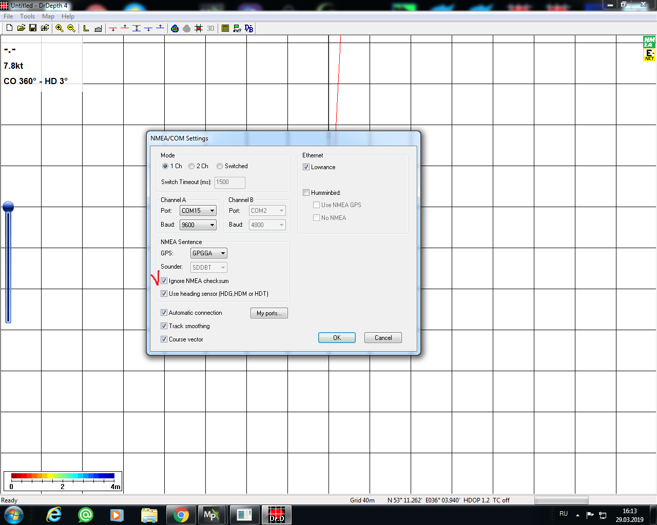
Randy i found that nmea out in MP not work in Reefmaster for live mapping. Meanwhile DrDepth works only if ignore nmea sum is checked.
*
I would appreciate your advice*
1 Like
So for the same price which one is better :
- Lowrance HST WSBL 83/200 + DST200
- Ping Sonar echosounder
Do you read temperature on your Lowrance ?
Do you have a picture on how you mount the echosounder Lowrance ?
@Plastic, re MP’s nmea out not working with ReefMaster, I’m not sure what to do really… if it’s an issue with MP itself then we could raise an issue in the issues list with details of the setup and see if Michael Oborne is available to look at it. I’m not familiar with DrDepth but I guess it’s a ReefMaster alternative… perhaps the “Ingore NMEA checksum” is a clue - perhaps MP’s NMEA output isn’t providing a correct checksum. I didn’t realise there was a checksum in NMEA…
@kikislater Sure
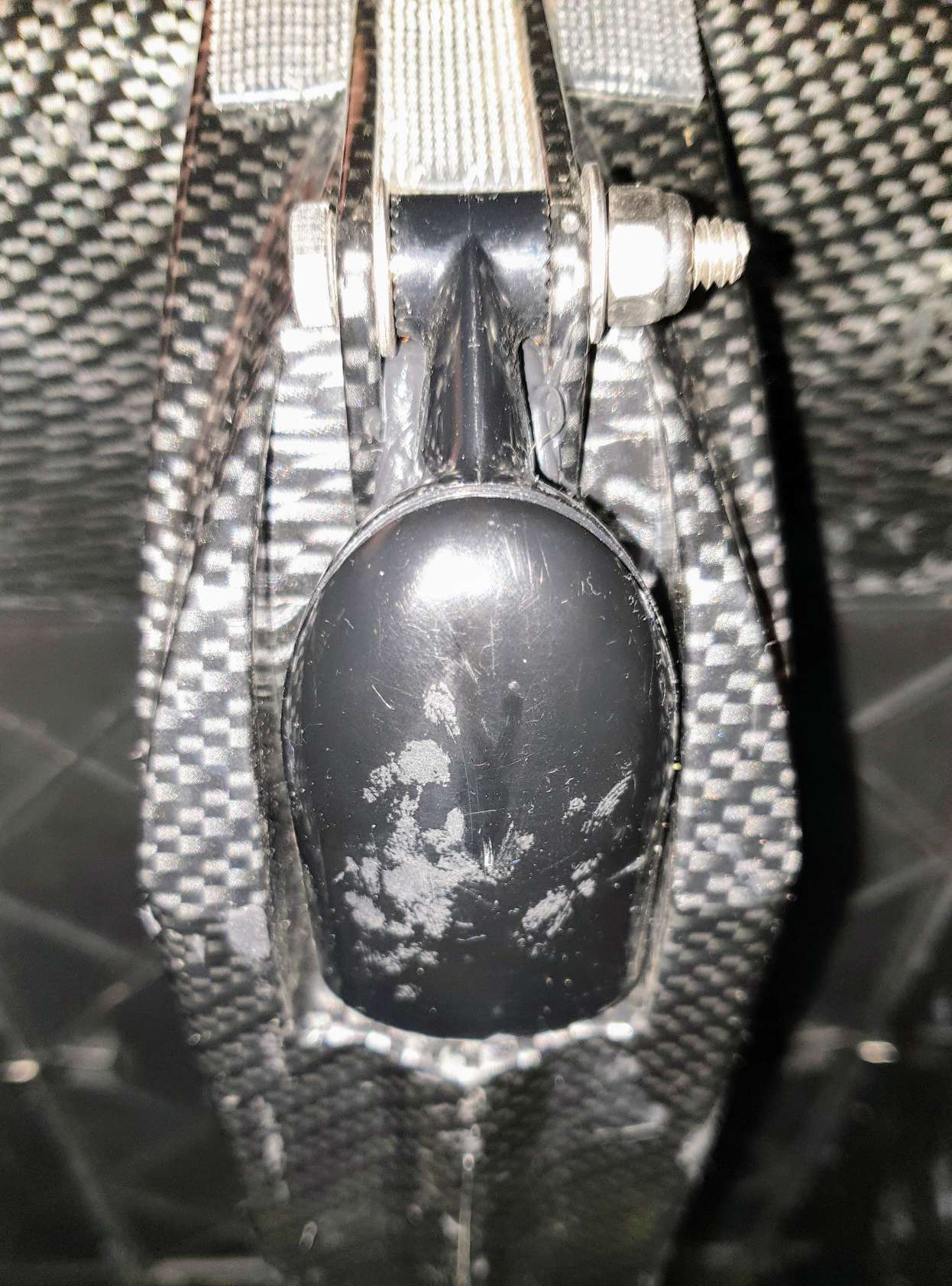
Transducer mounted in the mid section. The boat is designed to fit the transducer there by Carplounge.
You need to drill two holes horisontally for the bolt to mount the transducer so that it will pivot into the fitted position (see pict).
Then the third hole to thread the cable inside the hull. Cable is on the top of the transducer body. Measure closely before you drill, and size that hole so the cable passes through snugly.
Make sure to smear the bit of the cable entering the whole in Tec7. Then pivot transducer to push the last centimeters of cable in and tighten the bolt.
Finally cover the cable entry and the hole thoroughly inside the hull. And let everything dry up (do not touch anything) for 24 hours.
2 Likes
To do this you obviously have to cut the boat open and seal it afterwards. I assume you know how to do this.
If cutting the boat open is not to your liking… : The three dual lock velcro strips above the transducer is for my 3D printed Deeper Pro+ transom holder. I have some strips of velcro on top of the battery cover as well. I put a spare phone there. The Deeper app simply runs on that spare phone together with TeamViewer -“host” app on the boat. Then on shore I remote control it all with TeamViewer on my main phone/tablet/PC. This self made end result is pretty much equal to a full blown €1000+ fish finder & GPS package from Carplounge (the data for producing depth maps you simply export from Deeper’s Lakebook) 
2 Likes
Good to know thanks !
And thank you for others tips as well. Not for using in caplounge in my case
What about Lowrance HST WSBL vs bluerobotics one ? 200Hz vs 115Hz (Both proprietary system, same range of price)
Don’t know much about that alternative - so I can’t help there. And do use Tec7, not silicone. Carplounge has delivered thousands of boats and presumably know what they are talking about when they advice against silicone (I asked since I bought their kit and pieces and built it all myself)…
1 Like