Lidar advice please.
I have searched the documentation for a few days and cant find these specific answers to help me decide which lidar to use.
For a single forward-facing sensor what is the avoidance strategy? I would assume the vehicle would try a turn left and right and see which is the smallest direction when the object is no longer in FOV, is that correct? The published FOV for many sensors is in the range 0.5 – 2.0 deg. I assume in reality its much larger as things like poles could easily not be detected. Also, for multi sensors each one is allocated a 45deg segment so they must detect wider than 2deg?
There seems to be no option to use 2 sensors arranged front-left and front-right with slight overlap. Would this not be a good arrangement to allow very small turns to locate an obstacle?
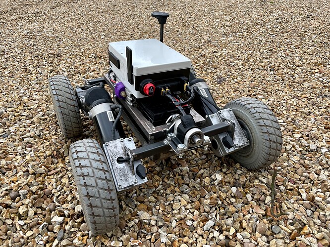
The cheaper 360 lidars seems very vulnerable to dirt with exposed belts etc which is why I’m favouring the single sensor option. Also, all the advice is to not have the GPS mast in the lidar FOV. This would be almost impossible. Can you allocate a ‘disregard’ segment for this situation?
I see someone has tried scanning with a single lidar attached to a servo. I assume this is not supported yet? (but is quite a good idea).
Looking forward to some replies here. Attempting to use a Lightware SF45 LiDAR on a large mower with limited success to date. And I fear its days are numbered as it is not sealed but it’s a learning experiment. Am looking into an automotive ultrasonic “bumper” type using multiple sealed sensors along the front unless a better idea surfaces.
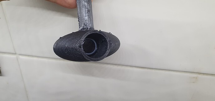
in dirty environments sonar and radar are really your only option, you could use a few sonar modules or rotate one with a servo like here:
I originally designed it for scanning underwater but it should work on the surface just the same, the main issue with sonars is they are really sensitive to ground reflections as they tend to pick up everything, even small defects in the road would cause it to stop. so you would have to make sure they are high enough or angled up so they are not picking up every bump in the road or make some kind of cone to focus the sonar in a smaller area.
The Wiki just shows 5 supported unidirectional lidars.
Im sure its probably out of date. Is there a list someplace of all the UD lidars that will work well with the Cube?
Are all versions of the RPLidar A2 supported?
Is the RPLidar S2 supported?
Hello @Vince_Hogg,
I have tried the rplidar A1 and A3 and both worked directly connected to the FC, you just need to add external 5v.
I also used the rplidar S2, with a companion computer I’m sending the proximity messages to the FC, in python using the Adafruit rplidar library.
Hello @Miguel_Castillo,
I am getting the data from the rplidar s2 to a companion computer using the Adafruit rplidar library but i am still struggling to send this data to my pixhawk flight controller.
Can you please guide me how you have managed to send proximity message to FC.
Thanks.
I have two TF-Mini Plus units mounted basically side by side (either side of a front center vertical rib)
I put the X/Y/Z location of the two Lidars into the configuration when I defined them.
Both point forward.
It correctly shows objects.
Park in front of a wall, and it shows two objects at the same distance.
Rotate slightly, so the vehicle is at an angle relative to the wall, and it shows one object slightly farther away than the other - and correctly accounts for the Right vs Left.
I haven’t confirmed this influences how OA works, but it makes sense to me that it would leverage the two to more rapidly determine the avoidance path (vs a single LIDAR where the vehicle would swing left/right to determine a course of action)
Hi there
Sorry I am new here and was wondering why Lidar? I fully agree with the radar but also why not cameras? Cameras can sense depth and machine vision and learning works. You also get stereo scopic cameras that is able to provide a 3D image
Just wondering?


