Hi all,
Hi! Based on a recommendation from Robotshop that the LLv3HP was working well in I2C with ardupilot, I went ahead and bought one for an octocopter that requires terrain following. We are using Arducopter v3.5.7 on a DJI S1000+, previous loiter was great with TFMini on serial bus. However we needed greater sensor range to avoid terrain failsafe errors when passing over sudden deep ravines or boulders, which caused a vertical position variance and RTL. So the enhanced processing and temperature calibrated range of 40m on LLv3HP seemed perfect.
We installed the LLv3HP lidar using 1000uF 35V cap on power lines to a dedicated 5V 3A BEC, hooking up to the shared I2C wires of the M8N GPS/mag combo on the Pixhawk 2.1 Cube, and at first no additional pullup resistors on the lidar SDA/SCL lines. Loiter/althold over grass performance was awful, resulting in wide sweeping oscillations of over 1-2m from setpoint of 5m. After talking to some engineers they said that we should try adding the pullup resistors, even though the pixhawk probably already has an internal pullup (the gps/mag reads fine). We tried 4.7kohm, 8.1kohm, and 10kohm resistors between SDA+SCL and 5V, the variability indoors (pointing at wall) was still erratic, varying 3-5cm every few seconds at 3m, but we tested loiter/althold anyway. We settled on 4.7kohm resistors as suggested in the lidar manual and did another test flight. Still not stable at all, gradually increasing altitude oscillations of 1-2m after 10 seconds, unacceptable.
DSAlt+SAlt Graph: https://www.robotshop.com/forum/download/file.php?id=8245
full log here: https://www.robotshop.com/forum/download/file.php?id=8246
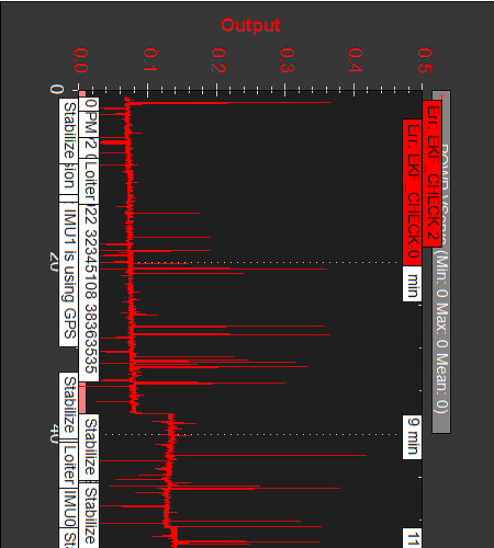
Looking at the logs we saw that the lidar was reading the correct altitude but there is something else wrong with the sensor or settings as it appears it is sampling every few seconds with low-res square data on the graph, weird. We used the lidar out of the box, we did not attempt to configure any settings besides in Mission Planner.
The logs show 4 flights outdoors with 15+ GPS satellites, over cement with small pebbles.
- RNGFND_GAIN 0.5, althold P 1.0
- Gain 1.3
- Gain 0.3
- Gain 0.8, althold P 1.3
RNGFND Params:
RNGFND_ADDR = 0
FUNCTION = 0
GAIN = 0.5
GNDCLEAR = 35
MAX_CM = 4000
MIN_CM = 20
OFFSET = 0
ORIENT = 25
PIN = -1
PWRRNG = 12
RMETRIC = 1
SCALING = 1
SETTLE = 0
STOP_PIN = -1
TYPE=15
EK2_ALT_SOURCE = 1
TERRAIN_FOLLOW = 1
For reference here is my original post on Robotshop: https://www.robotshop.com/forum/lidar-lite-v3hp-and-pixhawk-2-1-squarish-readings-t19461
Any feedback or suggestions would be much appreciated, thanks in advance! Hopefully this helps others avoid our same issues with the LLv3HP.
