Hello,
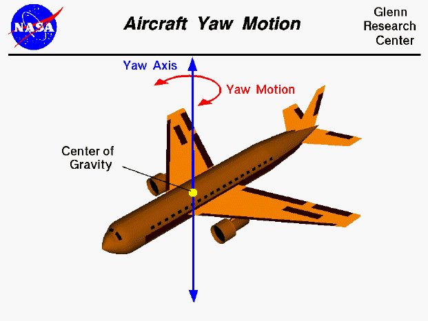
Two quick questions, what is the definition of Yaw in the DataFlash logs. While hovered over the variable I get “Estimated Yaw” however it seems to display heading rather than Yaw.
I expect to have readings of Yaw between -45 to 45 degrees at a push. Also, is it possible to display Yaw in the logs as well as heading?
https://ardupilot.org/copter/docs/common-downloading-and-analyzing-data-logs-in-mission-planner.html
In the link above, it states “The vehicle’s actual heading in degrees with 0 = north” but is Copter specific, is it different for plane?
Then for Altitude, again whilst hovering over I get “Estimated Altitude”. What is this altitude, height above sea level or height above ground?
Could someone please clarify both variables, it would be much appreciated!!!
Or if someone can send me a manual which shows the actual definations of all the variables that would also be great!
Many thanks,