Yes, you can load Mapbox maps. At least the “stock” sattelite view. Code use Api v4, key is “hard coded”.
Probably very inaccurate of me: A “stock” view from mapbox is just “a map”. When using the word “custom” and mapbox I refer to maps customized using the Mapbox Studio. Which may be based on the “stock” sattelite view or whatever view desired, but then altered in studio. I have as an example a lot of bathymetric maps for different waters, they are all included into one style. In QGC PR and now in a Tower version I work on, all of my bathymetric maps are now made available. I’ve used the mapbox Api to “retrieve raster tiles from styles” (link). The users needs a way to input the required mapbox account name, their own key and the ID of the desired style. And that’s it - the map is then customized in Mapbox, and always available in the GCS… (my usage is obviously for a boat)
so the ability to define this url
/styles/v1/{username}/{style_id}/tiles/{tilesize}/{z}/{x}/{y}{@2x}
is the key here. as well ass the user acess token.
eg
curl "https://api.mapbox.com/styles/v1/mapbox/streets-v11/tiles/256/1/1/0?access_token=YOUR_MAPBOX_ACCESS_TOKEN"
ive just updated MP beta, and includes a MapBoxUser
this will prompt for the mapbox ShareURL
enter it and it should work
Hello Michael. It works fine. Thank you.
Can you describe how to clear custom mapbox tiles?
currently there is no method for removing an entire cache history.
you can delete by age, but not everything.
the manual way is goto
C:\ProgramData\Mission Planner\gmapcache\TileDBv3\en
and delete the folder for what tiles you want to remove.
Hello Olav! Nice to see your struggle for bathimetry in ardupilot. I guess Tower is more interesting for fishing and mapping than Qgcontrol ( you can rotate map and ad more zoom). Can you share your version of Tower?
Buy the way this summer i intalled on rt4 Raymarine Dragonfly 4pro and wifi reapiter on the bank (very impressive). Guys from Carplounge somehow add possibilyty to read raymarine depth messages in their app ( so its possible to add tracks to Reefmaster ).Looks like Navionics Boating.
Tower’s simplicity makes it an ideal partner for bait boat usage. But it’s outdated. I have some help renewing it, and a fair set of ambitions on needed (bait-)boat focused adjustments. Hoping to reach a milestone by the end of this week, then I can help you out. Testing needed, you know…
I had no time to test the beta of Mission Planner yet. Stupid question, perhaps: How (from where) did you install the beta?
And a big thank you @Michael_Oborne 
Hi Olav. To intall beta you need to select Help colomn and select Chek for Beta Updates:slightly_smiling_face:
@Michael_Oborne: Finally understood how to install the beta.
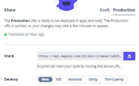
Really easy to set up the mapbox maps this way. Thanks. One thing though: I have several styles. So I tried to switch from one style to another (pasting a new shareURL). What I see is that the tiles already downloaded from the first style is not changed. Second style appears only when I zoom to a range that I did not use with the initial style.
Is there a way to re-download the map in order to alter the appearance (from one style to the next)?
currently no, check my post about 4/5 up
Hello,
If i use custom map like this link : http://vps.oborne.me/gcs/CustomImages.htm
the map will contain elevation data ? Because i need my elevation data in MP to fly more precisely.
Have a good day 
to use elevation data you need to do it differently.
please see Custom Imagery in Mission Planner
I’m on it thanks But no message in my console, and no geotif data on flight plan screen
Hello Michael,
I am trying to use tiles with Inject GE maps. I can do it with Global Mapper, but the tryal version has expired and I can not use it any more.
Now I am using QGIS, and It has the posibillity of exporting in Tiles as adirectory, I have exported a set but when I go to Inject GE is like it doesnt recognice the map set.
QGis exports as XYZ Tiles format ,
https://docs.qgis.org/3.10/es/docs/user_manual/processing_algs/qgis/rastertools.html?highlight=xyz#generate-xyz-tiles-directory
Do you think this kind of tiles are supported by MP?
There is also another question, I found very useful when using MBtiles with a transparent layer over a base map, I can see both. Have you think on it? To have the posibility of seen 2 different maps, one over the other.
Thanks a lot for your incredible work.
Hey. I followed the steps outlined earlier in this thread - but used Pix4D to create tiles. When I go to import the map nothing shows up. Any help on this matter would be appreciated.
can you upload a sample tileset somewhere?
I was setting up a u-Blox ZED-F9P with u-Center a couple days ago and came across a feature that I thought would be helpful to some using ArduRover that want a simple custom map if the feature could be added to Mission Planner.
In u-Center in the “Map View” you can select any image and then georeference it with just 3 known coordinates. After that, real time position information is displayed on the new map. This would be super useful to me since the satellite imagery for my area is old, I have access to pictures shot from a drone, and with a RTK F9P getting accurate coordinates in my yard is easy.
Michael, please let us know what you think. See Section 5.2.10.2.2 of the u-Center Manual.
MP support geotiff’s and world files
https://gdal.org/drivers/raster/wld.html
normally these images are already georeferenced
also 3 know points asume the image has been orthorectified. ie everything is 100% top down, so using a single photo for example would not work correctly
MP support all these are inputs
https://gdal.org/drivers/raster/index.html
I tried to create a GeoTIFF with QGIS here but when I put it in the C:\ProgramData\Mission Planner\srtm folder “nothing happens”. I was expecting to have my image displayed in the area that I am working in but it is still Google Satellite Map and blank if I select Custom. I guessed at settings in the QGIS Georeferencer so that might be the problem as well.
I am aware of the limitations of using a simple approach with only a couple coordinates and one image but I didn’t think the errors would be significant since I am only interested in the 100’ x 150’ area of my yard.
The srtm folder is for dem’s. If it’s aerials need to use the gdal button instead