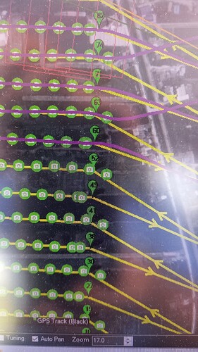
Yesterday we flew a mapping mission and I noticed a strange phenomena.
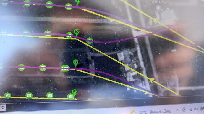
When the uav approaches the turning point, it triggers the camera apparently on the waypoint radius. Even if there was a camera trigger just before that, it triggers again. This can happen within a few hundred milliseconds after the last trigger.
This creates a problem as it sometimes is so fast, that the camera misses this trigger. This results in less pictures than cam events. That in turn makes it impossible to do geotagging in mission planner.
Please have s look at the pictures from the screen I took during our flight:
You can clearly see at waypoint 60 what I mean

