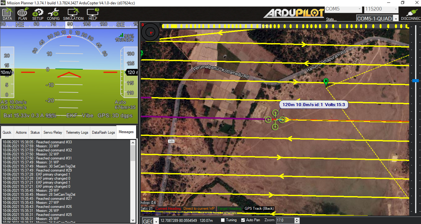
planned for 1Sqkm area to map with Sony A6000 using Pixhawk autopilot at 10m/s ground speed.
waypoint file attached here:

waypoints were flown expected and i have noticed that mission planner didn’t show me the photo taken area while flying, but after completion of flight camera has the images .
During flying I also noticed that EKF primary changed between 0 and 1 continuously as you can see in the message tab.
after trying to geotag the images using mission planner and other software as well but faced problem that mismatch between trigger message and number of photos taken .

used Emlid Reach m2 for PPK and taken hotshoe feedback timestamp using other software.
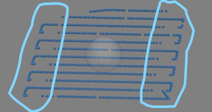
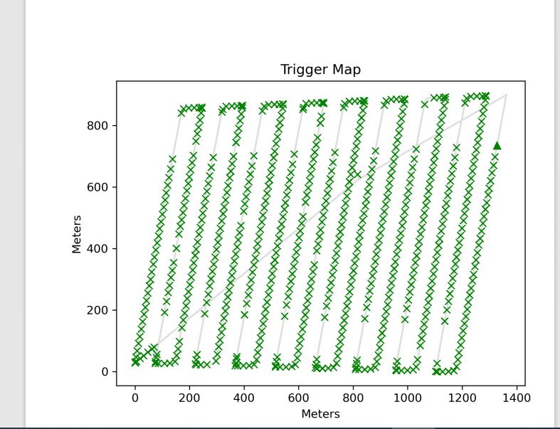
why its stop triggered entry of the every waypoint on both side and while turning it should not taken photo but here its showing that taken photo.
log file also attached here:https://drive.google.com/file/d/1vecoxAfjzrI-mcQxwiSIFsd9NsCInCvN/view?usp=sharing
waypoint file :https://drive.google.com/file/d/1e8olCT29zBajlnf67cPdeNe_wBooDqms/view?usp=sharing