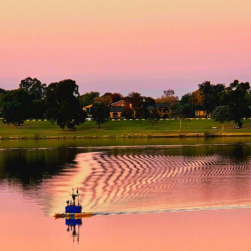
Hey Mick,
lots of options, im happy with my choices, but whatever works…
T200 + standard ESC’s work nicely at 20v good speed and efficiency
Paolo - the standard ESC is just a PWM RC input. 1500 is zero 1000 is full reverse 2000 is forward…
try a servo tester on the PWM signal of your ESC’s - you need voltage across the ESC - if all is good - it should beep on power up. Talk to Blue Robotics - their support team is excellent if this doesnt work.
Flight Controller - Boats are low tech and slow so whatever works. I used an old pixhawk. H743 stuff is excellent - if you need lua scripts, check out it meets the requrieents first - most 743 stuff does.
I used M8N gps - good enough. Waterproof it !
comms - antenna’s - depends on the range you need. Check the pics for the ones i use - apprx 200mm and massive range in the km’s - but line of sight. You need to matchh the frequency to your legal laws. NZ works on 915mhz legally up to 1w, check your laws and purchase a couple of RFD900x + antennas to match. (or other telemetry stuff) Wifi works well - but i havent pushed that past 1km.
Find an RC Controller and receiver. The reciever must have PPM (signals multiplexed into 1 port) to play nicecly with pixhawks - lots of choice here. If you muck about a bit you can piggyback the RC signal over the RFD900x’s which is very cool for long range control and telemetry
Batteries - i use 3x 4Amp 20v ozito batteries. 3d printed connectors that slide over the terminals, going to an XT60 connector. 3 of these joined up in series gives 12Amp/hr of capacity - which gives around 7km of range. NZ $120 (USD 80ish) for a 3 pack of these batteries !! Ozito battery packs are high quality with an excellent BMS. Wasted on powertools.
https://www.bunnings.com.au/ozito-pxc-18v-4-0ah-battery-quad-pack-pxbp-440_p0595324
RTK - na, unless you need that precision. The $30 M8N is excellent for my needs. $500 RTK if you need it…
Controller - i use a taranis with D4r2 FRsky receiver. Its older, but i like it. Im thinking 6 channels minimum. More is better. I use 4 im thinking. The Ping1d depth sounder records onto the ardurover and goes over the telemetry.
FPV - i use an old android phone with the free and awesome IP Webcam app. Streaming vid over wifi with H264.
Yep - 3d printer is a learning curve - designing parts needs some 3d design software skills, the alternative is to buy ready made.
My biggest recommendation - weight control - keep your boat light, and it will travel far and fast.
good luck !

