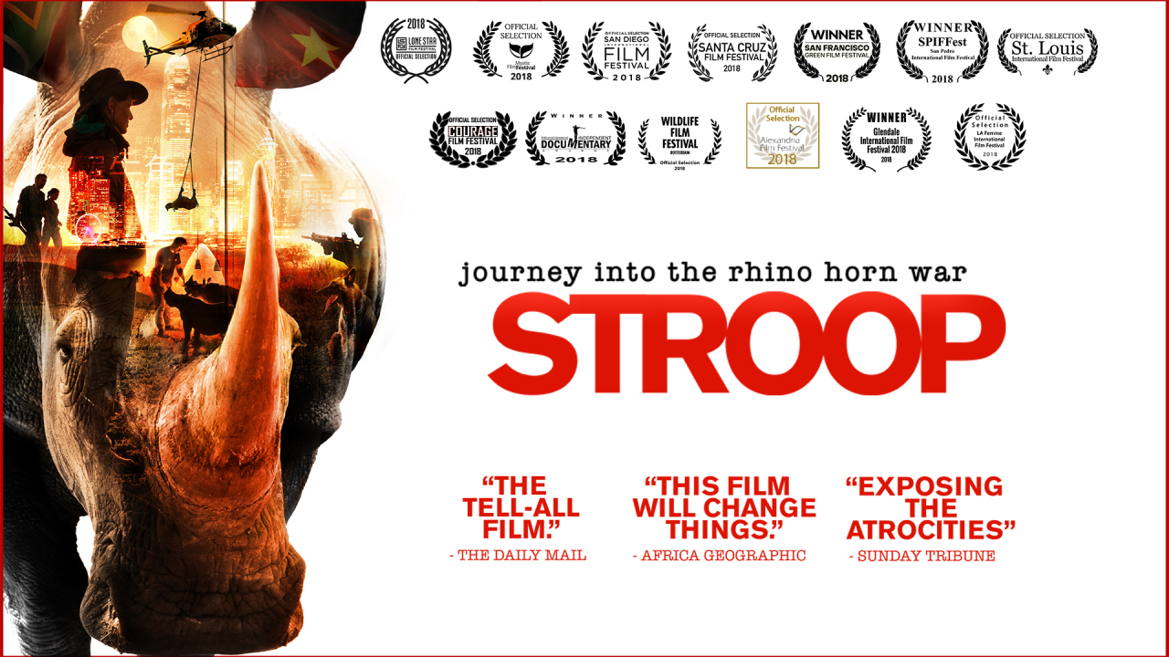
I think as a start try watch a movie called “Stroop” it really highlights what we are up against and the war we are
Fighting against seemingly insurmountable odds. Some reserves will find a drying rhino minutes after its been poached. Our problem is getting enough people and co-operation involved in this. Add the fact that a successful anti poaching drone is an autonomous human hunter and we are in very difficult territory I am willing to collaborate with anyone who can help because we have to win this war and drones are a vital component in this fight. I didn’t expect that
It would costs anywhere near as much as it has and I expect that I am in for another 1-2 million of my own funds. I am just thankful that we have some very skilled people who have come on-board at no cost because they understand we have to win this war.
One of our engineering contributors is involved in military development and we are currently looking at combining a mini radar system with thermal, IR camera and visible camera. The onboard AI will evaluate the data and if it works the way we hope it will, you will not be able to hide from a UAV with this system onboard.
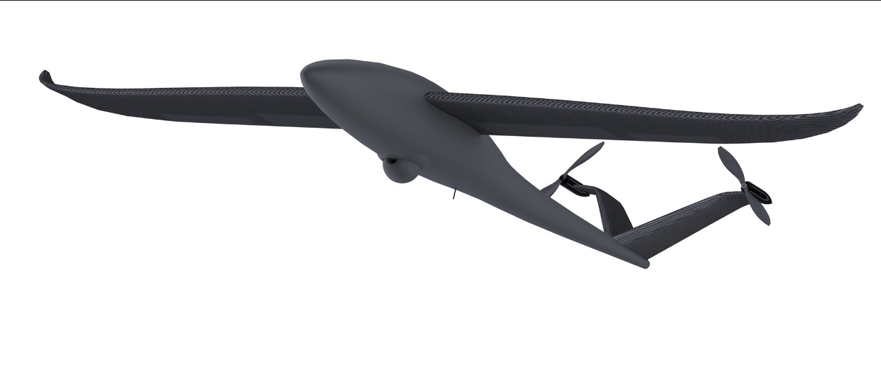
I wasn’t going to upload yet as the rendering doesn’t show the front motors and props, the flaps, the elevators and only has a gimbal shell but this is the current airframe design.
Hi Robert. If your objective is to stop the poaching, I think your time/money would be better spent on sensors, processing, and deep learning rather than on new airframes. It may seem useful to have VTOL, but in an established battle ground like Kruger, it would be more reliable to use one of the runways or set up a catapult for day/night operation.
WHAT runways, Ronald? Skukuza has the only asphalt runway and it’s 80km (50mi N) from Kingfisherspruit (202,878 acres), one of the poaching hotspots, N’wanetsi (236,627 acres), another hotspot is 90km (60mi NE) and Stolsnek (172,126 acres) is 60km (40mi SW). There are few if any dirt runways within 20km of the hotspots. And note, a hotspot can be quiet for weeks or months and then suddenly rangers find 3-5 fresh carcasses.
Catapults are cumbersome, complicated and noisy so we used bungee’s with great success. That was the easy part, we launched in the veld or off a dirt road (after doing a thorough check for lions/hyenas/buffaloes/elephants/rhinos/hippos and leopards. Landing was another story, try landing a 40km/h aircraft in the pitch dark where you can’t see your hand in front of your face on a narrow dirt track in high crosswinds surrounded by 10m tall knobthorns (acacia nigrenscens) and 1.5m tall thatch grass. Also planes don’t do well landing at 40km/h on a dirt road covered in 2 inch corrugations (washboard).
A couple more notes from our PM:
You cannot apprehend scared, armed people who run like wild animals at night in the African bush.
You cannot get within 2km of them in a vehicle before they’ll run when they hear the vehicle.
You cannot walk an anti-poaching team to them, in the dark, through lion, elephant and buffalo-infested bush from 5-10km away, (lions catch and eat people here BTW, especially night-blind people stumbling around in the dark - night vision equipment is very expensive!) while the drone tries to keep an eye on them (retention) and hopefully they don’t run off into the bush in the interim.
VTOL tech was still in it’s infancy then but would have been a perfect solution for reliable launch and recovery, so Robert is spot on with choosing the VTOL path as it would have saved us countless headaches and emergency repairs.
Guys, for a better understanding of the rhino poaching epidemic PLEASE go watch the film “Stroop: Journey into the rhino horn war” (https://www.sdbfilms.com/stroopabout)
It’s available on Amazon, Google Play, iTunes and Vimeo, all funds generated go to anti-poaching efforts
I do care for those animals from a biodiversity perspective as well as from the perspective that every person has a right to live. I think there is no significant moral difference of killing a human or a non human animal. The only significant difference is the reason why one does kill. But I wonder if there is an ethical problem with what is done here, especially because it is probably not against the real criminals but against poor people working for them. If so, I think it should probably be solved in a different way.
After reading the thread I wonder if it’s possible that at the end there will be a “nice” surveillance drone which is suitable for other tasks but not for the intended one? I wonder if this new drone has the same limitations as the once used before?
I also ask myself if even if the drone is initially better than the previous ones the poachers will soon find cheap ways to avoid detection, e.g they could detect incoming drones with RF or sound scanners and hide under a blanket or they could use jammers, cheap attack drones or simply shoot them down.
I think that a surveillance solution is an approach to mitigate the symptoms of the underlying problem. It is important to do but only part of the solution. When reading about the amount of money spend for this solution I wonder if there are any more efficient ways to invest that money against poaching.
Since the detection rate is so low, would it be probably a similar or more successful solution to establish a on ground sensors network within the main approach routes of the poachers?
Regarding who is killing the rhino’s, the demand for the horn is from the middle and far east and yes it’s the local poor population who do the dirty work, but they know it’s illegal and they do earn quite a bit of money for each horn and become repeat, professional offenders . For them it’s just a commodity like cocaine or gold and worth about the same.
But do yourself a favour and watch the film Stroop, it only costs $10.
Tobias, that’s exactly what our drone is designed for, aerial surveillance. We have already included aspects of search and rescue etc into the design specifications and we are also working on a power tether system.
Given the really interesting people here, maybe its time to divert from the air frame and talk a bit about the sensor systems we need. The problem we have is that we can’t just rely on thermal imaging or cameras, we need something to go a long with it. The one thing poachers can’t do without is metal, which has a nice big radar signature. What we want to do is to build a very small 360° radar array that can detect metallic objects over a reasonable distance, say 1km. We are thinking that we would connect the radar array to an AI that will filter the contacts. If the radar detects metal, the gimbal will turn so that the thermal camera is looking in the detection region and the AI connected to the thermal camera will try detect a human contact. If the thermal AI can’t a 3rd system will switch on Black IR LEDs and the low light IR camera will feed footage to the AI to see if it can detect a target.
The trick is getting the radar small enough and accurate enough.
What about passive RF detection? Do the poachers use or carry walkie-talkies or cell phones?
This may be much easier than radar as no active transmitter is required. I also fear short wavelength radar may not work very well in areas with thick foliage which has a very big radar cross section and also blocks the signal. Long wavelength radar will require very large antenna arrays and the effect of a person may not be very big. In addition, the low bandwidth will lead to a poor range resolution.
In the smaller reserves poachers keep their cell phones off and don’t use any form of electronic communications. The only thing they can’t do without is metal in the form of axes, pangas and rifles.
So, a couple of things need more explanation please.
First, you said canines do a good job. Why not then keep using them?
Secondly, you said that when intercept teams go out to apprehend the poachers, they run away before you can catch them. Why then is UAV detection, or any kind of detection for that matter, important? Why detect if you can’t apprehend?
Finally, you said thermal doesn’t work well in your conditions. Why is that?
Canines are great when you are tracking a poacher but the bush veld is massive and you can’t allow them to roam free because they will get killed by the larger predators. There are also scorpions to worry about and the fact that the poachers will try kill the canines and sometimes the rangers. There are not enough rangers to patrol the areas and moving across a reserve is often slow work with dense bush offering lots of place to hide. A UAV can cover more ground, give you a birds eye view making hiding behind objects harder.
The problem is most of the incursions happen at night and the temperature is often still in the high 30°C The air is hot and the rocks that have been baking all day are as hit as humans. Thermal cameras rely on temperature contrast but don’t work well when everything is hot. You can’t tell a human from a rock and the contrast of everything is low due to the ambient heat.
Are you aware of any uses of radar for such small types of target? Radar (ground oenetrating) seem to be in vogue right now, with a recent high visibility example being the P-38 being found in Greenland. However, your need is very different. This was a 15m wingspan plane, scanned relatively close up. You are looking at small metal items identifiable at long range (the longer the better).
In theory it might work but do you have any field data? Do you know what types of radar you might try? (I don’t, I am just asking).
In terms of AI, (thermal, RGB or whatever), you should be able to produce loads of data by “cheating”. One cheat is I think employed by some anti poaching team (might have been conservation drones, but I can’t seem to find the link) who use a game engine to produce computer generated data, faithful enough to the real thing to train the algorithms on. Another way might be to stick a camera up a tall structure (or a drone if you have to), dress up a bunch of “poachers”, give them each a GPS (ideally RTK or PPK) and have them walk about in the camera’s field of view. You know the vector from camera to “poacher” through the GPS trail, you know the cam orientation, you can work out the bounding box around each target and you have made yourself a dataset. There will be a lot of details to work out and perhaps there won’t be enough info in the dataset for the algorithms to latch on to for 100% automated detection but still, an algorithm that is biased towards false positives can still reduce the workload on a human operator by a huge margin. The vast majority of your data is empty (no detection). If you can confidently throw it away and have your crew concentrate on the 1% or less that has simply been labelled as “potentially interesting”, you will save yourself a lot of effort.
We are doing something similar to the game engine. We are feeding thermal images from a variety of cameras into an AI and letting it work out what the best shading for a human analogue would be. We will then capture the analogue in different poses and in motion from a huge variety of angles, simulated altitudes and contrasts producing labelled data. Next we will take actual footage from the region and use it to create tress, rocks etc. The final step is to generate simulated random live footage and see if the AI can detect humans and in the cases where it can’t we will label the human in the footage to retrain it.
why not track the animals instead of the poachers? Seems like it would be a easier task, I guess some have radio locators in any case. Not sure how viable it would be?
Too easy for the poachers to take them out before you can get to them and we are talking about reserves with huge expanses and animals that are spread over the entire reserve. There are also no fences around many of the reserves so the animals can move freely from one to the other. One of the reserves we are working with is 400 Square Kilometres (154 Square miles).
I guess your running more of a boarder patrol then trying to cover the whole area then. What happens when you spot a poacher? I guess you cant get identifying video from the UAV so you would have to try and catch them in act. If you use a full size heli then they have lots of notice and you will have to clear the area of the UAV first but then other methods would take ages. Certainly a tricky problem.
I guess that is a good way to describe what we are trying to do. The UAV will do boarder patrols and also search when a poacher is running from rangers. We are working on a tracking system where the UAV will automatically begin to loiter around a contact, once identified and continue to track them as they move. It will relay GPS co-ordinates and camera footage to the control room who will dispatch rangers to apprehend.
 I am willing to collaborate with anyone who can help because we have to win this war and drones are a vital component in this fight. I didn’t expect that