Hi Alex,
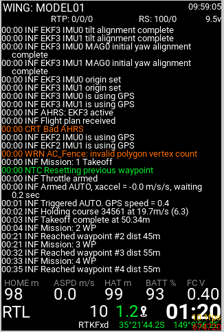
on an X18S with Ethos 1.4.5, a percent sign is probably missing after the green “99”:
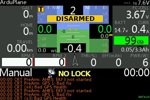
A special character is displayed instead.
(Widget Version 1.0.0 dev)
Hi Alex,
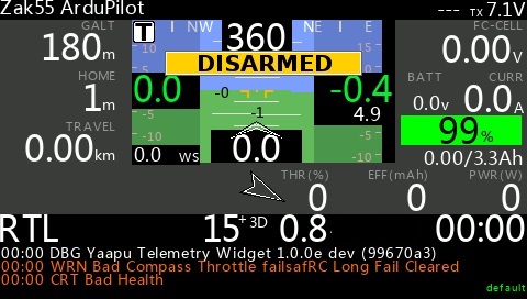
on an X18S with Ethos 1.4.5, a percent sign is probably missing after the green “99”:
A special character is displayed instead.
(Widget Version 1.0.0 dev)
X12S is fine on 1.4.5 and the intunal ISRM with a RX8R
Hi Reinhard,
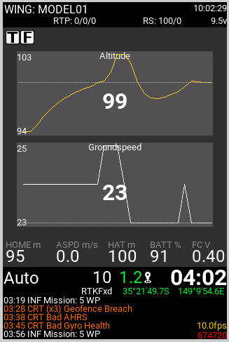
on the sim is all right, not sure what to check, the font seems to be correct since THR is fine
Hi Alex on the X12S Lua Sources is there on 3 ?
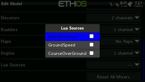
Hi Colin, that’s the Ethos mapping widget, not the ardupilot one
so there’s no Lua Sources for Telemetry script sorry my bad look at the version 1.0.0e lol
now i have Lua sources with 1.0.0 beta1
i was trying to work out how to get these new flight mode to play sound what trick is loaded
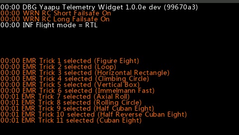
OK I see, best way is to parse incoming text messages, generate hashes and sound files, if you can get a list of the status text messages you’d like to process I can help out
did some digging this is about all i can fine
plane_aerobatics.lua (81.2 KB)
Scripted Aerobatics.txt (10.6 KB)
mesages.txt (599 Bytes)
Very nice!! I have an el18. Can the current version support it?Can you provide a copy of the lua?
Hi, not ready yet, need to complete some internal testing first, a new layout on a new radio means potential for emergency mode or cpu kill issues ![]()
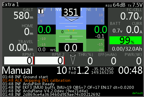
more screenshots
Waiting for your good news!!
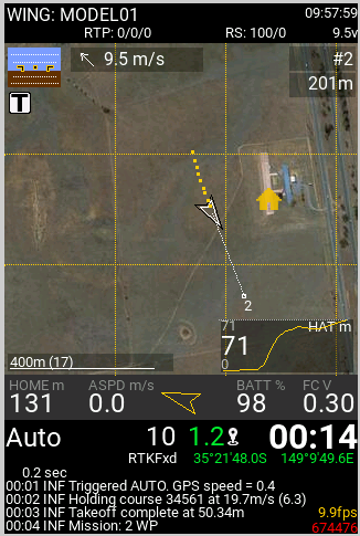
I just updated to try the new map view and it looks awesome! A small issue while installing was, that the sensor discovery of the GPS sensor only works after you have a good GPS lock on AP. Did the sensor discovery indoors first and this took a moment to figure out, but now it works flawlessly.
The only issue I´m having now is that GMapCacher is extremely slow. I would have the internet bandwidth to download data at least 10x faster. I would like to use QGIS to generate tiles. Do you have any information on what tiles the script can process? I know it must be 100x100, but stuff like
Zoom levels in QGIS are from 0 to 25 with 25 being the most zoomed in (so it´s reversed).
Hi David, glad you like the new layout!
Did you try MissionPlanner as tiles downloading tool? Have a look here
I never used QGIS, I had to reverse engineer the gmapcacther tile engine and the missionplanner tile engine to support them so to support another tile engine a new tile backend is required, not an immediate task ![]()
I’d like to thank FlySKY for donating an EL18 radio to this project and @Risto for making it possible!
Hi Alex,
Glad to see you are working on Flysky Tx Telemetry sript. I own an old NIrvana N!4, which I have just updated to Edgetx 2.8 and was trying to add this sript.
When do you thing we could get a funtional script with N14 layouts ?
Will they work for Betaflight?
Thank you for you efforts to offer this nice task.
Best regards.
Marc
Hi, I don’t have a date for you, there’s still some development and testing to do, and
it won’t work with betaflight, it will require ardupilot using ELRS/CRSF or FrSKY telemetry, it also works using a mavlink based FC paired with an external mavlink to frsky converter like the MavToPT project.
…first simulated mission seems ok
Hi Alex,
Using MissionPlanner to download tiles is probably even slower and there is no option to download multiple regions as a batch process.
The good thing about any GIS program is, that you can export whatever format you want or need for your application if you know the technicalities. With a GIS application you can import, view and modify any map source (online or offline) and thus would be a very powerful addition as a map source for your project.
I could make a short tutorial (QGIS e.g. is free and open source) on how to export any map with multiple regions, even including overlays, etc, but I would have to know the specs of the format your script can read.
ok, what I need to understand is how the QGIS generated tiles are mapped on a world wide grid.
How many horizontal tiles, how many vertical tiles, how big each tile is, where’s the tile origin (top,left, bottom, right, center?), how are the tiles saved on disk?
gps coordinates are used to calculate the tile coordinates on a world grid, and once you get the correct tile you need to calculate the x,y offsets and convert them to pixel coordinates and from that to screen coordinates, so basically I need to design a “driver” to consume those tiles.
Could you generate a 200m square of 100x100 tiles at max zoom for reference centered on
so I will compare them with the tiles system I support?