Hello All
I Mount Pixhawk Cube black on the drone and seeing data on the mission planner. We observed altitude reading not correct it shown wrong data and also store wrong data on SD card. some time it stores the correct reading on the Pixhawk SD card but on mission planner, it shows the wrong reading but mostly it showed the wrong altitude on mission planner.
I also try by connecting Pixhawk with USB and notice altitude on the mission planner but it shows again wrong altitude and altitude value also variable.
Yes Sir, I already read this.
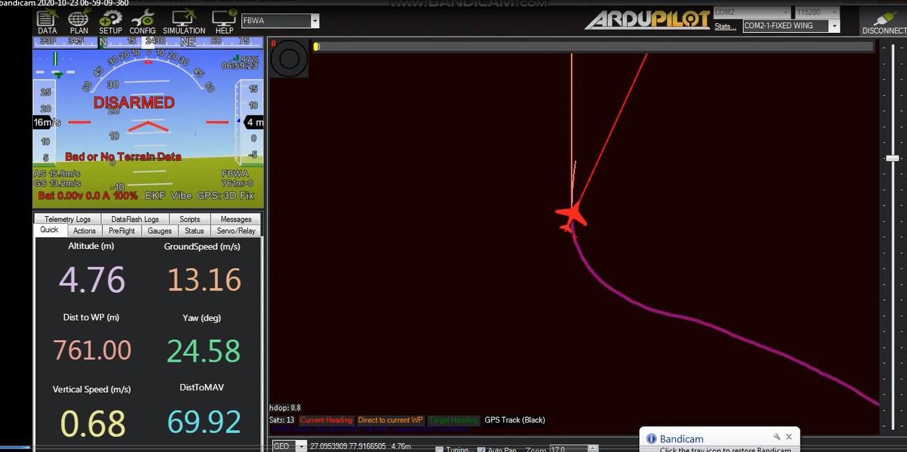
Sir i have test pixhawk on the ground. my drone has a height of approx 300 meters. but in the mission planner altitude shown as only 6 meters
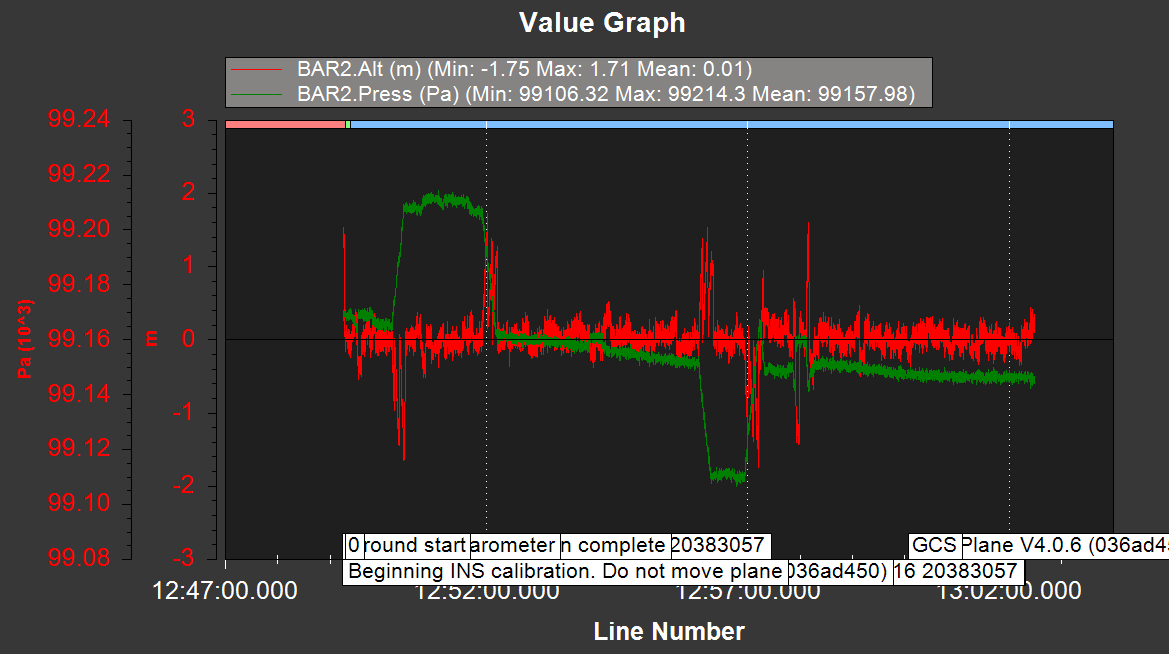
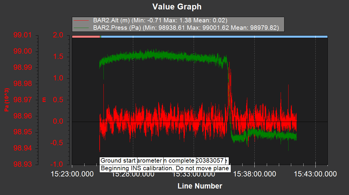
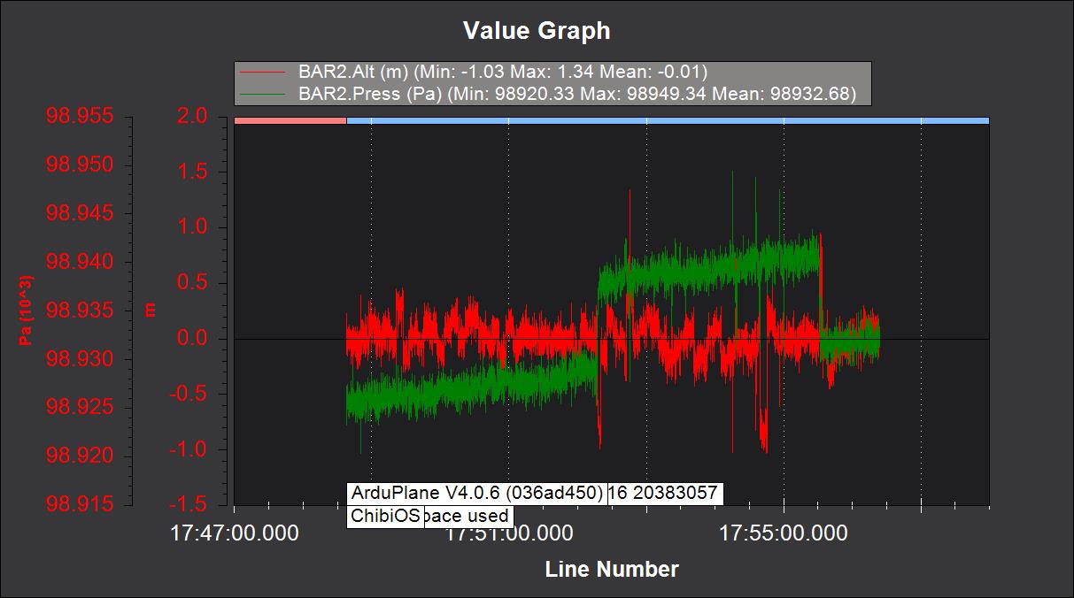
I have attached some images of the log data and mission planer screen.
on the mission planner is shown “Bad or No Terrain Data”
In the image red color shown altitude and green show pressure(pressure change according to height)
I think you have not understood the concept of relative vs. absolute altitude.
Where are you expecting to see the 300m ?
Sir i want to see 300m on mission planner. if my pixhawk on ground it show 0 and when my drone fly it show altitude reference to ground means if my drone height 300m from ground(home) it shown 300m on mission planner. Or it may give ASL or AGL or may be from Home position https://ardupilot.org/copter/docs/common-understanding-altitude.html
ArduCopter reports “Altitude above home location” (AHL) correctly. I still do not see what is your issue.
Sir my drone at height approx 300m from ground home location(AHL) but it has shown only a maximum of 6 meters.
Sir, i want the mission planner to show the real-time value of AHL.
How good is your telemetry connection? Is the data getting updated when the drone is far away from the ground station?
Do you have dataflsh logs? load them to plot.ardupilot.org and have a look yourself.
Sir all connections are good. I also getting updated data when the drone is far away but the altitude value is wrong. i have storing log data into pixhawk SD card.