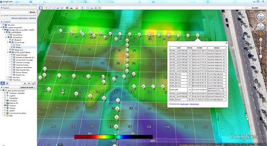
Hi, Ive got a couple of network “holes” on the property im testing mowing on, and suspicions around our outdoor wifi access points. A wifi heatmap would help pin point this issue, or at least highlight the poorly performning wifi devices.
Before i hack together a wifi chip ( ESP8266 ) reporting RSSI and overlaying it on a map, along with RFD rssi, - is this something that
- already exists (pointer please)
- will exist, with the new networking support in ardupilot - eg wifi strength parameter
- or too trivial to warrant a script (just record the rssi on a mission)
- include ping time with mavlink length packets - eg telemetry should work/notwork
- include ping time with video length packets - eg video should work/notwork
- go 3D allowing drone mapping of signal strengths
- nice 3d interactive plots. - like the following maybe qgis

- mission planner overlay ?