Thanks for having me in the group, I am an experienced fixed wing and VTOL pilot, but not used to using Ardupilot. I am programming a VTOL mapping mission for a particularly tricky location and I am wondering how I read the WP altitude in mission planner.
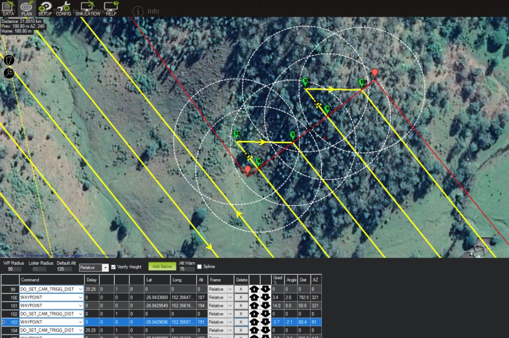
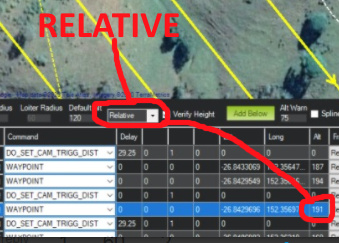
In the example above, the altitude column for WP103 says 191m, but the SRTM altitude for that point is 260m AMSL so I would have thought either the WP alt should be 120m (the height I set above the terrain) or 380m (the AMSL height plus 120m). So what is the 191m about? Should I be concerned that it will fly my aircraft into the side of the hill at WP103???
I just recently started practicing with terrain following with my fixed wing craft using the simulator with xplane11. I dont know where your home is or its AMSL, but you have verify height checked and I think that can affect the altitude setting of way points. One thing I use if I’m unsure of my flight path altitude is right click on the map>map tools>elevation graph. That should show your flight path relative to the the terrain if it followed your points exactly.