The Mission Planner docs on Geotagging show a different screen than the current one - looks like there was an update to this that didn’t get documented.
There are a couple of “altitude” options that aren’t really explained in the current docs.
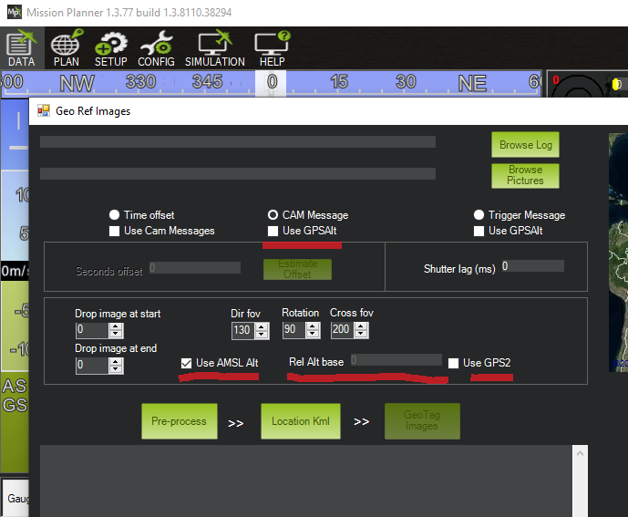
For example - what does the “Use GPSAlt” option do. Is it different than the “Use AMSL Alt” option?
@Michael_Oborne mentioned that ArduPilot/Mission Planner uses EGM96(MSL) altitudes - not WGS84 Ellipsoid altitudes. (the two altitudes possible from ublox) So maybe the “Use AMSL Alt” simply does just that.
But if that’s true - what does the “Use GPSAlt” option do?
I’m just guessing - but does the “Rel Alt base” simply use the barometric differential from “home” to determine the altitude - using the base altitude that can be entered?
And also just guessing - does the “Use GPS2” simply mean use the data from the secondary GPS for this data?
Thank you!