I’m creating a bunch of missions which have pre selected lat lon. I’ve been just copying the lat lon, into a .waypoints file. I understand most of what the columns are in the CSV but some I am not sure what the values represent
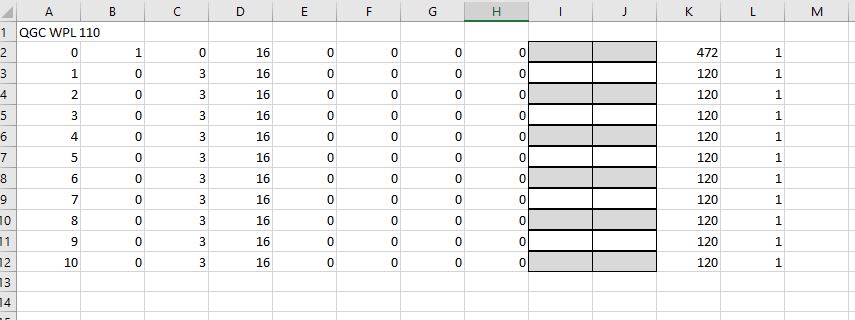
A- waypoint number
B- ?
C- ?
D- ?
E- param1
F- param
G- param
H- param
I- Lat
J- Lon
K- altitude
L- ?
Altitude seems to be represented by another column, I’m guessing B or C as to whether altitude is AGL or MSL. Anyone know what the other columns do, or where to find that info?