Hello,
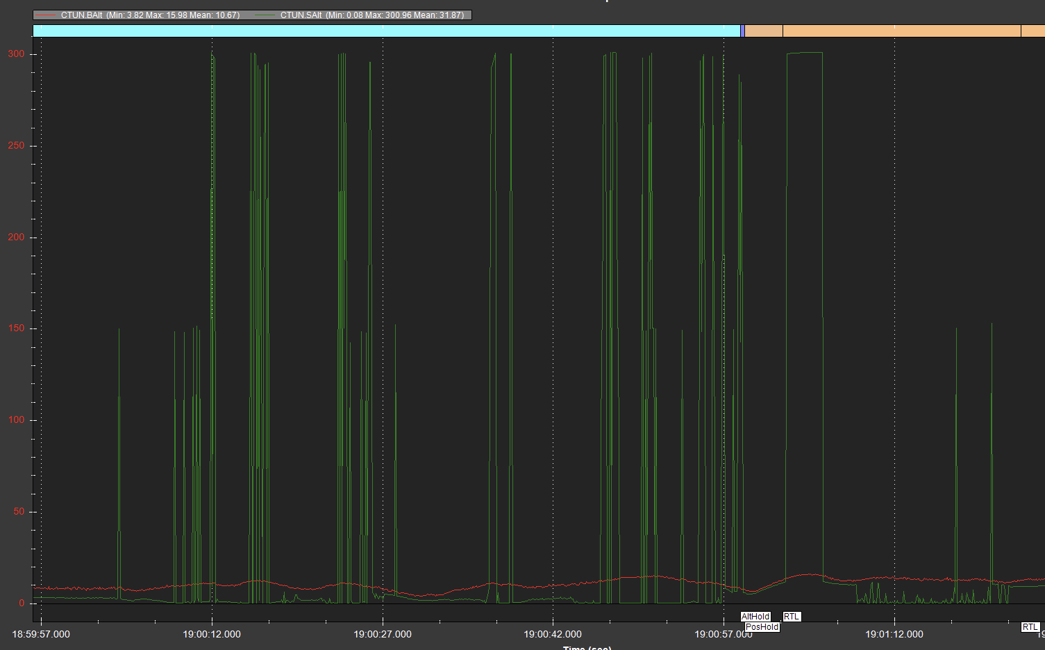
I am using the Cube Orange Plus flight controller. In my setup, I have a TF02-Pro LiDAR sensor facing downwards beneath the drone and a TFmini Plus LiDAR sensor facing forward. The motors I am using are Hobbywing X6 motors, and my drone is a hexacopter. I am also using Mauch current sensors to measure the instantaneous current drawn by my drone, which helps adjust the mot_batt parameters accordingly. Additionally, I have tuned the PID controllers using autotune, and the adjusted PID values have proven to be effective. However, I am experiencing a significant issue with the altitude hold of my drone. Especially when in Auto mode, the drone is unable to maintain its altitude and exhibits oscillatory movements. I have extensively investigated this issue but have been unable to find a solution. Moreover, sometimes when the drone is in the disarmed state on the ground, its altitude fluctuates. It can change by 1-2 meters, sometimes even up to 5-6 meters.
Additionally, I am using a flow meter. My drone is an agricultural spraying drone, and I pass the spray through a flow meter. The flow meter acts similar to a current sensor and generates bat2_monitor values. I uploaded the parameters as well. I am attaching the flight logs of the flight where I encountered this problem, hoping that you may notice something that I might have overlooked.
Flight log: 2023-06-12 11-57-44.bin - Google Drive
Paremeters: parameters.param - Google Drive