Queensland, Australia
From May 8-12, the AirMap team joined technical professional services company Local Government Infrastructure Services (LGIS) in Queensland, Australia, to explore the possibilities for drone use in emergency management and emergency response functions, such as assessing the status of infrastructure, delivering critical supplies to remote locations, and more.
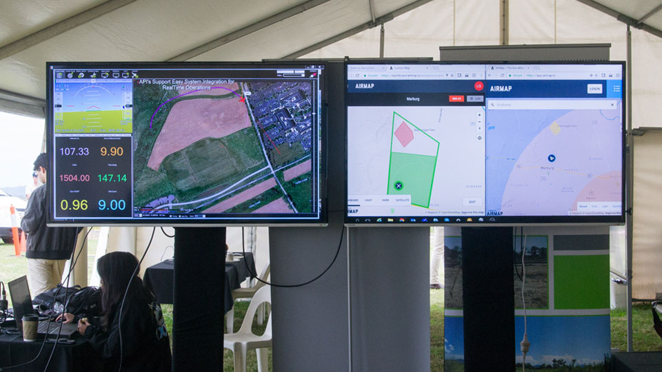
Together with Scout Aerial, AirMap successfully demonstrated the ability to transmit real-time telemetry data, send command and control messages, remotely modify flight paths, and manage local low-altitude airspace for multiple, simultaneous BVLOS drones operations, all over Telstra’s LTE network.
Thanks to the foresight and outstanding performance of LGIS and other participating partners, Australia is one step closer to making drones part of everyday life.
https://www.airmap.com/putting-utm-test-queensland-reno-nias-nasa/