I’m starting to use Terrain Following but hesitant.
In create a mission:
I’ll change Relative to Terrain
install waypoints
right click Flight Plan screen
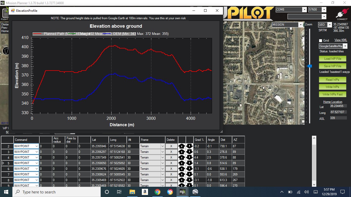
select: Map Tool/Elevation Graph which shows the ElevationProfile screen with the correct graph. Perfect.
BUT, when I “Save WP File” and “Load WP File” the Terrain graph disappears. Its like I have created a mission in Relative.
Just trying to double check if that WP file will work before I load it on my plane and run it into a hill.
I really like using the ElevationProfile screen.
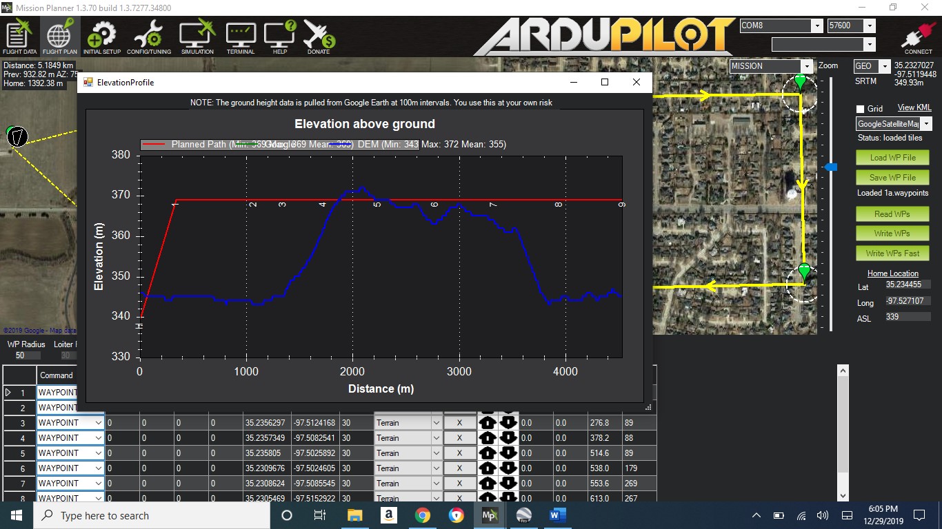
Yes you can - in MP on the right hand side near the Save and Load Wp buttons, there’s a “View KML” link that will open the mission in Google Earth and you’ll be able to see the track in the air and the track across the ground.
Shawn,
Thanks for the KML viewing in Google Earth. It worked as long as I created a mission and NOT saved it and viewed it in Google Earth.
This before and after saving the mission file.
I found a work around:
MP 1.3.69 or 1.3.70 WILL NOT WORK but
MP1.3.68 and MP 1.3.67 WILL work on my PC HOPE pilots that have been flying “Terrain” check before they fly