Hi,
When a DEM has been preloaded, is there a way for the program to take it into account during the calculation of the entire trajectory (terrain following), instead of considering it only at waypoints? (see attached image)
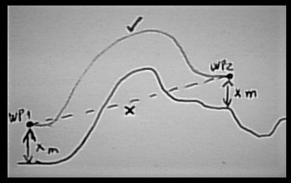
Or, at least, some way to detect and warn that there is some point on the calculated trajectory where the UAV will collide with the ground.