Still have elevation graph problem in latest 1.3.53 version

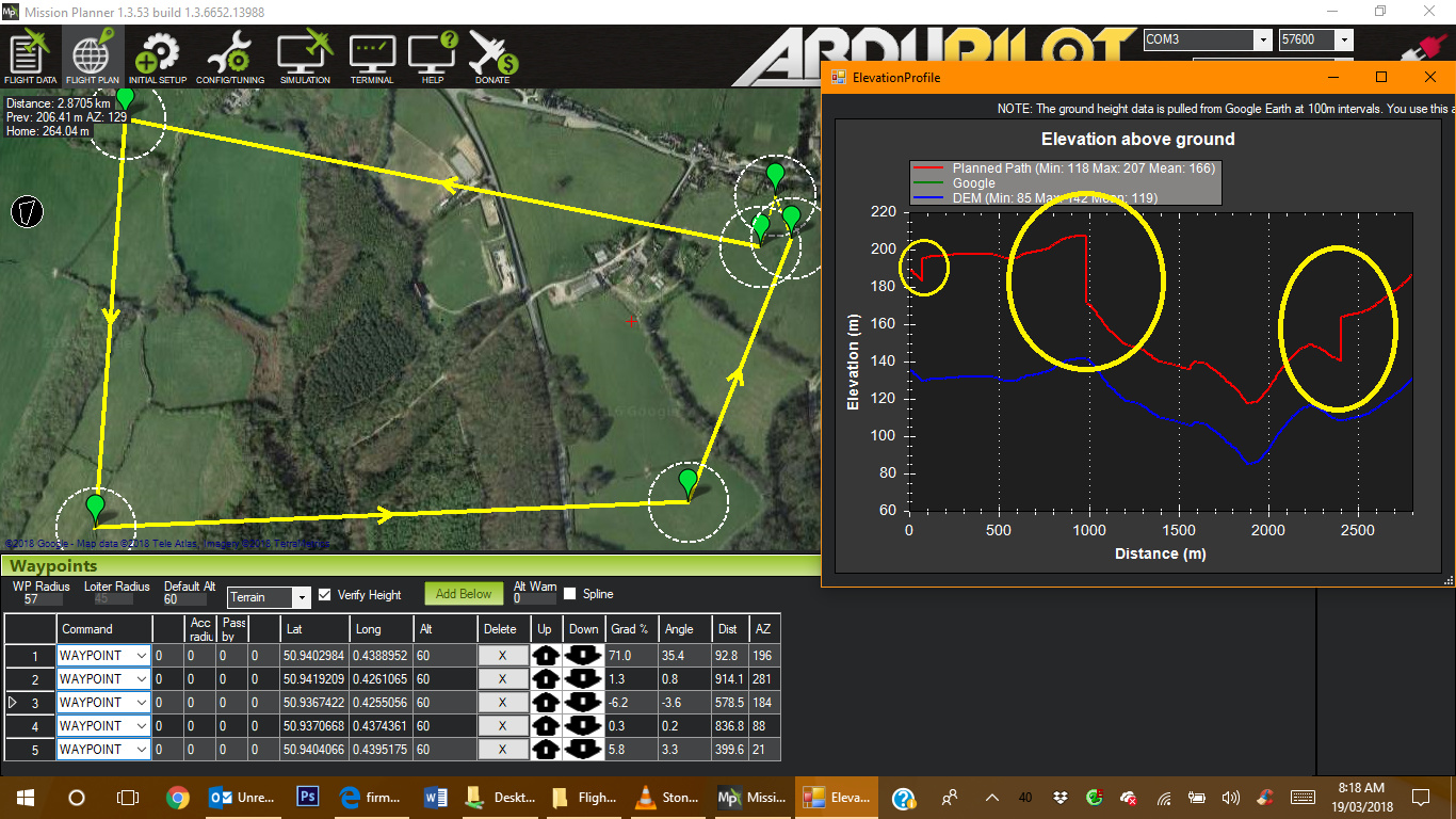
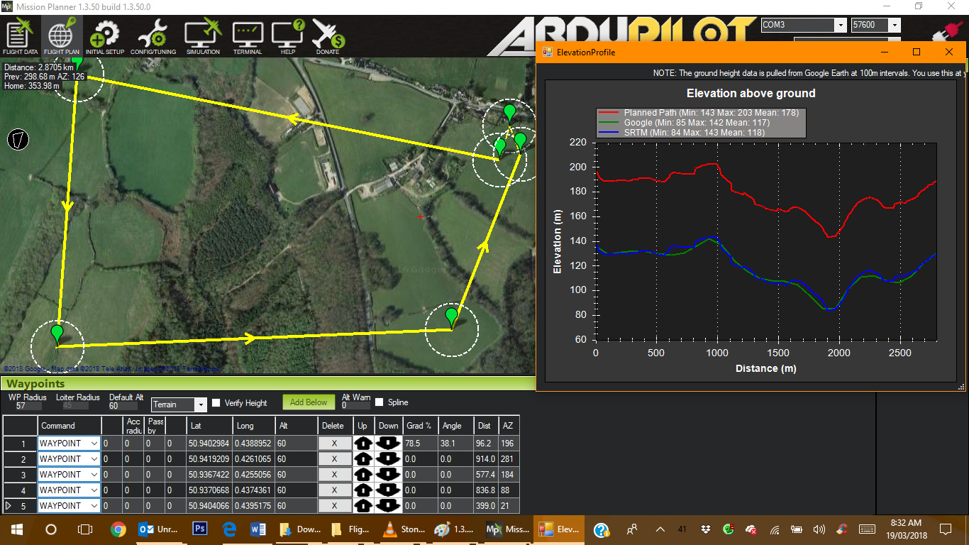
I’ve noticed this problem with Mission Planner since 1.3.51. In Plane mode it gets the elevation graph wrong. In the screen shots below from 1.3.50 and 1.3 53 the same mission is loaded. Its a terrain follow height of 60m above ground in a simple square.

In 1.3.50 it charts it perfectly a constant 60m above the ground. In 1.3.53 it shows a sudden climb, drop then climb in altitude (circled yellow). On some missions in 1.3.53 it shows this drop below ground level.

Also, in 1.3.53 it’s not showing the green Google info line in the graph.

Version 1.3.50 - Correct

Version 1.3.53 - Graph wrong

Thanks for this, ive fixed this in the very latest beta version.

both are actually wrong. as the first one doesn’t show the first wp as 60m

this should all be fixed now though.

Hi Michael, I just tried the latest beta and still has same problem unless I’m on the wrong beta.

Do you have a link?

I think the terrain in 1.3.50 was correct as launch altitude was about 135m and shows flying at launch at about 195m with terrain set to 60m

please check 1.3.55.

make sure you home alt is correct as well. as this has a influence on the output