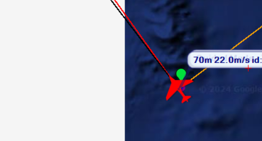
I am flying a VTOL near Tuvalu (a South Pacific island) on the ship, and it is positioned on the borderline of the mission planner map, as demonstrated in the video.
In the video, you can observe that if I click on the waypoint to the east, the route does not cross the borderline and instead heads west.
To pass the borderline, I set a guided waypoint directly on the borderline, as shown in the video. However, this method is inconvenient, and I cannot take the fastest route (the shortest path) if I use this approach.
I think this is something you should raise as bug or feature request in the MP Github. I just checked, in QGroundcontrol you have an endlessly scrolling map, maybe creating the flight plan there and importing it to MP would work?