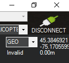
My elevation data is showing 0 with an invalid message. I looking at the area of interest, approximate 56 lat and -130 long. Looked up the SRTM folder and it’s sitting there all uncompressed and ready to go. Some areas I have lidar data so I can bring in a geotiff, but not for a few areas. Any ideas? I can always load the srtm into Global Mapper and export it to the SRTM Mission Planner folder, but there’s got to be a better solution lol.
I am having the exact same problem. Mission Planner 1.3.80
Any update?
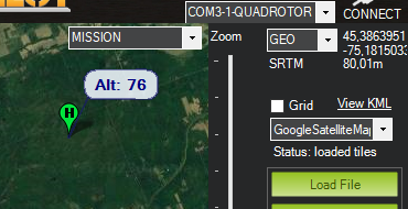
Testing this here it show up for me around that coordinates
mission planner 1.3.80
I guess MP downloads tiles from https://terrain.ardupilot.org/ . Maybe you’re having connection issues?