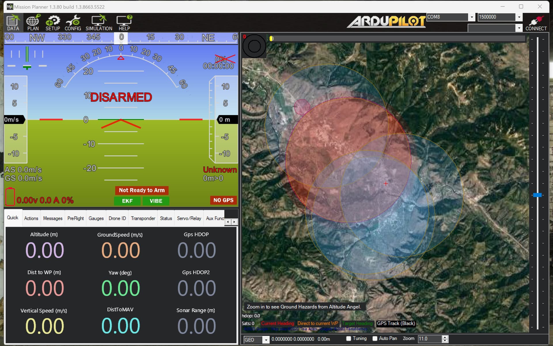
This is a screen grab from the local area I fly. Recently I have been noticing the airspace delineations are getting a bit garbled and are actually not depicting true realties especially when it comes to TFR. If you are not going to show accurate information regarding active TFR’s then you should not show it at all. The faa has facility maps that would be more beneficial to show than these random circles that are not actually depicting any relevant information
Not entirely sure where this information is coming from but it is not valid and wrong.
Does it goes away when you click set ShowTFR to disable on conig/Planner ?
Do you have AltitudeAngel enabled
Do you happen to have a tfr.xml in your Documents/Mission Planner folder ?
even if these are enabled (which they are) displaying incorrect airspace data is very dangerous no matter. where is the TFR source coming from?
Nowhere, tfr public service that was used by MP was discontinued in 2020, and later the support was removed from MP as well. So this is strange. If it is not a new install, then this could be some residue. This is why I asked the questions above.
new laptop from about 2 months ago never installed MP on it until then.
This is coming from Altitude Angel, if the restricted zones are not refreshing then it is not connected, do you still have a valid account and logged in to altitude angel ?
(Note : Altitude angel is a third party plugin to provide access to the services in Mission Planner, and to update it you have to have a valid account)
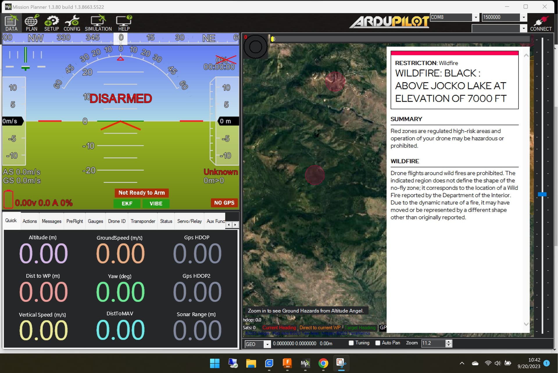
Edit Find the two fire related TFR’s on the AA website, it shows that they are still active. So it is AA’s issue, they did not got update from FAA or whatever agency is issuing drone tfr on wildfires
yeah their website has very old tfr’s on it I have sent them a email. it’s either accurate or it should not be displayed at all even as a option to turn on or off. Inaccurate airspace information is a very dangerous thing.