Mission planner out in the field?

Sorry if this is an obvious question, but it’s one that is escaping me.
Mission planner works with google maps to allow you to set way points. My question is… If you’re out in the field, how does this work? Chances are, out in the field you won’t have WiFi to enable connecting to the internet to get your google maps.

OR do you simply have to plan your flight while connected to the internet, create your flight plan, upload it to the drone, then set it loose?

How does this work? I’m baffled.

Thanks
Rick

You can cache maps while connected to the internet and on the field the system will use the cached data.

1 Like

In a pinch, I just tether. But, I also have a 2 in 1 laptop/tablet (HP Spectre x360).

If caching a map, is it safe to assume that you are not able to update your way points in the field?

Hi bigTulsa, what do you mean tether? Using your cell phone as a hotspot?

Tethering with my cellphone…correct.

Caching the map is only for your convenience. You can always set waypoints even without maps.


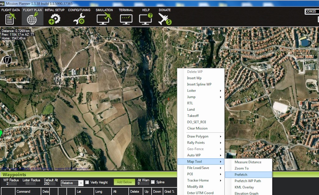
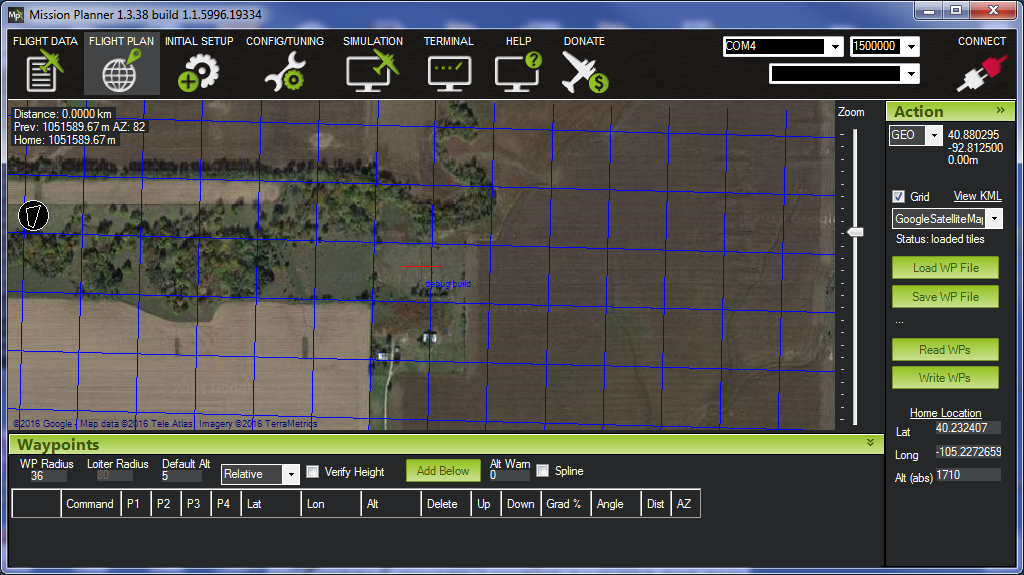
Yeah, but without visual cues on the map, it’s tough. I prefetch typically just in case. I have three or four places I frequent, so I make sure those three or four places are prefetched.

What’s harsh is that I have ATT… I’m always getting 1 bar on my phone.

Interesting. I have ATT as well and always have at least 3 of 5 bars on my Android Phone. LTE. Usually more than that.

you can plan a mission at anytime in MP.
if you dont have image data you can turn on the grid.

when zoomed in it provides a 100mx100m grid

2 Likes

Grid is a good tip thanks Michael!

However I’ve never seen my prefetch finish. I’ve even left it overnight before, on an area 1 x 1km. What am I doing wrong?

Hi Michael
If you don’t have image data, what does turning on the grid do for you? Wouldn’t you just see a blank screen with a grid on it?

yes blank screen with a grid.

Yes, you can create and manipulate missions whether using cached maps or live maps.