Hi ! I need your smart advise.
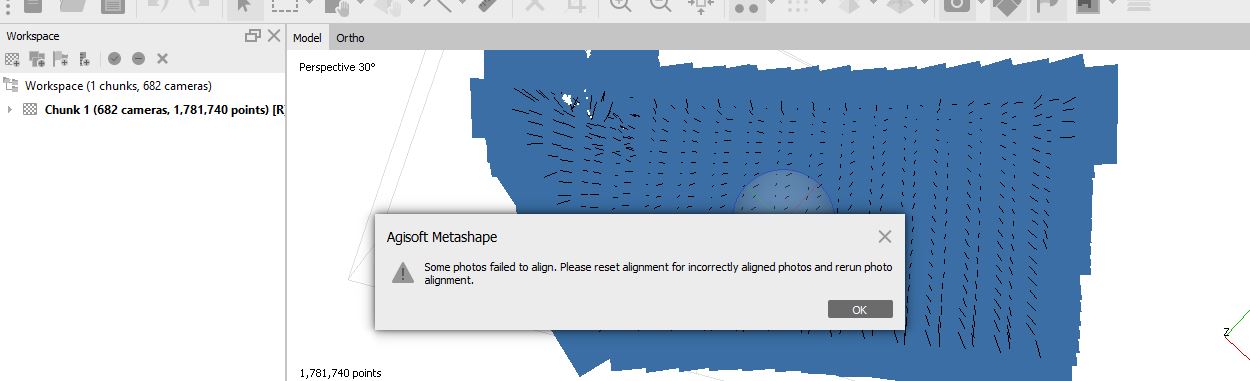
I am working on a research project and use the Mission planner for the first time. Specifically, I faced difficulties while merging photos through Agisoft. When I am trying to merged images the error on fail images occurs. Now I’m trying to figure out Does the ussue relate to Mission planer or Agisoft itself? Please help me to answer this question
If you need detailed information, please let me know, i will share it
What kind of error.
Do you have enough (at least 60-70%) overlap ? Did you managed to geotag your images with Mission Planner correctly ? (This is the only task that Mission Planner is involved in the merging process)
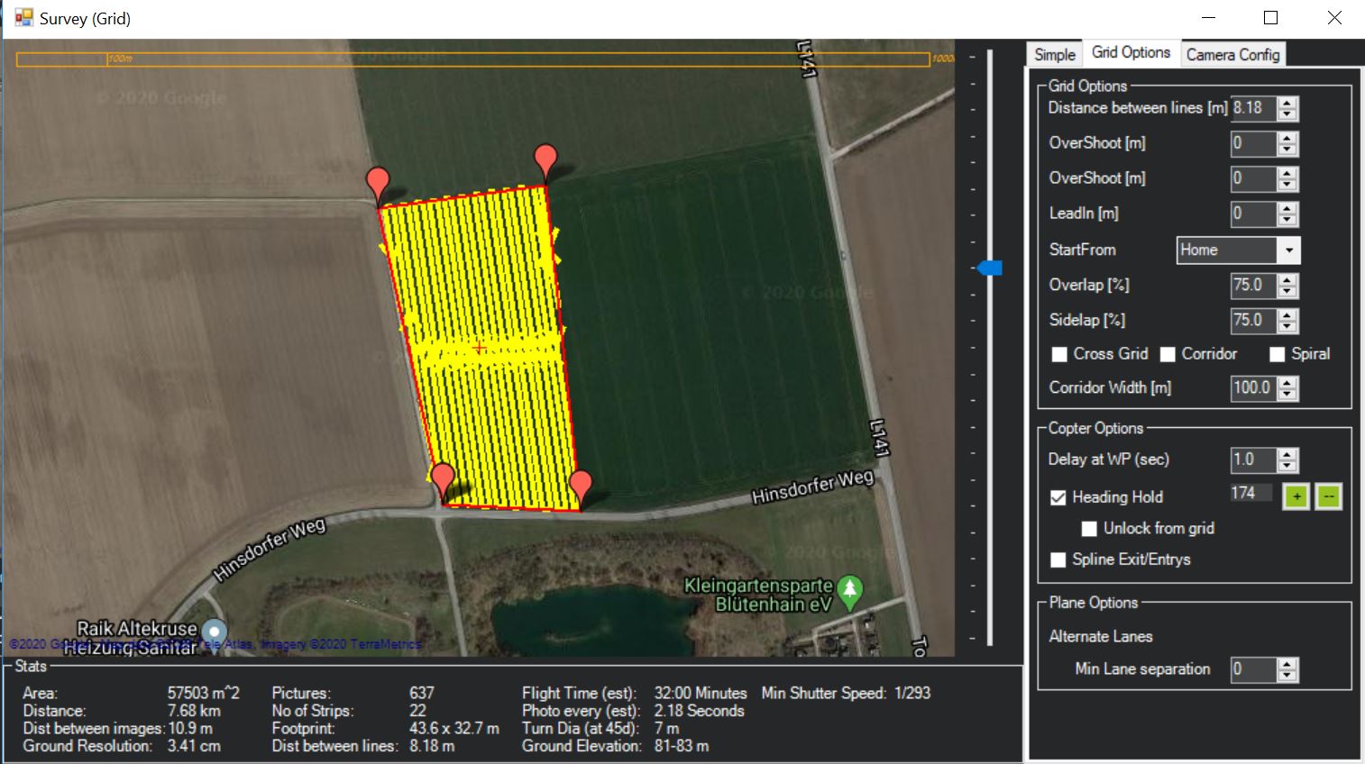
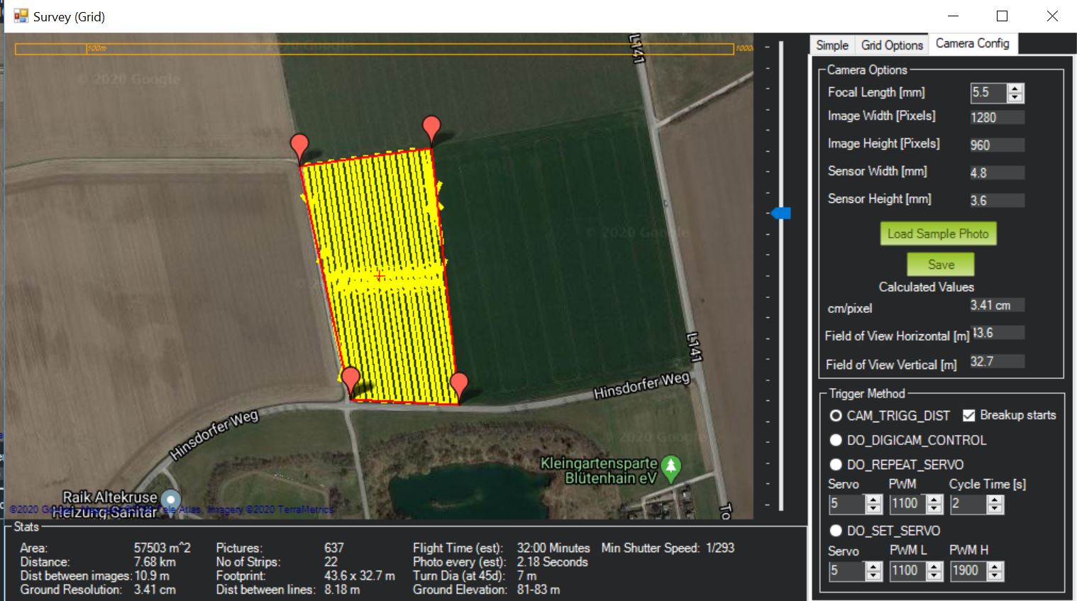
Yes, Agisoft did overlap of 70% area. My final goal is to calculate NDVI using drone images (Multi-camera system).
To do this, I use the Mission planner following bellow route:
Create polygon --> Autu WP --> Surve Grid --> selected Advanced option --> Simple–> unselected Markers --> selected Red Edge on panel Camera --> unselected Camera top facing forward --> selected 5-- > selected Use speed for this mission --> unselected use RTL --> selected Angel (deg) --> Altitude (m) --> 50 m
