Greetings, colleagues. I have a few questions.:
I am engaged in lidar, magnetic, spectrometric work on a hexacopter.
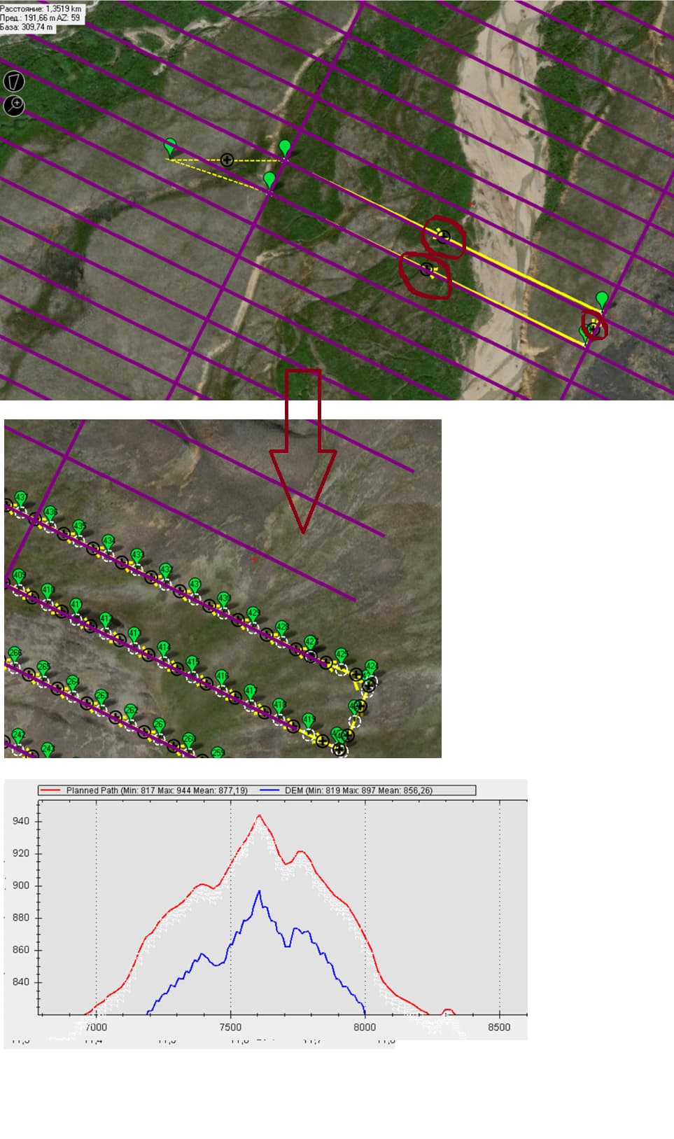
To fly over mountainous terrain (using satellite ultra-precise terrain-DEM), I set points every 20-25 meters so that the copter bends around the terrain more accurately, more frequent points slow down the copter, and more rare points impair the accuracy of the envelope. If you set points larger than 25 meters, the copter can accelerate from 5 m/s to 7-8-10 m/s, depending on the distance of the next point.
-
is it possible to use the “TERRAIN” mode instead of “ABSOLUTE” and upload a high-precision terrain to an SD card with a resolution of 1 meter by 1 meter and fly in fog without telemetry? (in fog and clouds, I can’t rely on the rangefinder because the beam reflects off the water)
-
how can I make a quick autocomplete of points along the drawn route in the mission planner? (without pressing the “+” button and without auto WP) . in the photo.