I am writing this email to request your assistance with an issue I have encountered while using the Pixhawk 6C flight controller. Recently, I purchased ten Pixhawk 6C flight controllers along with ten M8N GPS modules.
I installed the GPS modules on all ten drones and successfully completed the calibration and PID tuning process. However, I have been facing an issue with the GPS module labeled “M8N GPS Module” when operating in loiter mode. After some time, I receive an “Unhealthy GPS Signal” error message on the Mission Planner software HUD, even though the HDOP was 0.7, and there were 18 satellites. Although the flight was smooth, I landed the drone immediately to avoid any crashes.
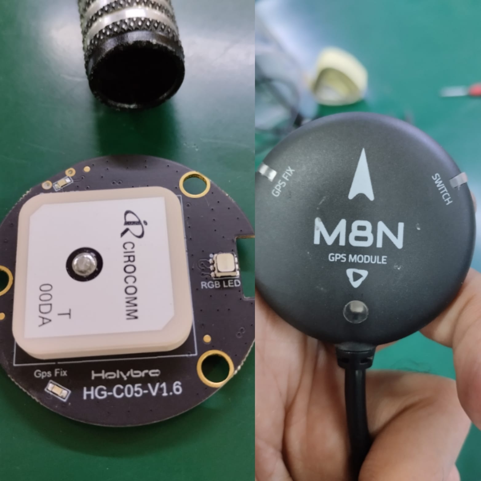
I have tested all ten drones with the M8N GPS module, and the issue persists. However, when I used the GPS module labeled "Pixhawk 4 GPS Module” which I received with pixhawk 4 flight controller 3 years back, with all 10qty drones there was no “Unhealthy GPS Signal” error, and the flight was smooth. Upon inspection of both GPS modules, I found that both had similar hardware, but the version printed on the “Pixhawk 4 GPS Module” was “Holybro HG-C05-v1.4,” and the version printed on the “M8N GPS Module” was “Holybro HG-C05-V1.6.” As both GPS modules have similar hardware, I am now seeking your assistance in finding a solution to this issue.
I would like to inquire whether it is possible to install the “Holybro HG-C05-v1.4” firmware on the “M8N GPS Module” to solve this issue. If yes, I would appreciate your support in providing me with the firmware and the procedure for installing it.
Kindly find the attached files.
I implemented this change and observed that everything worked well, with the chosen option representing “GPS and Glonass” constellations.
However, I have concerns regarding the feasibility of delivering drones with the GPS_GNSS_MODE parameter set to value 65 in different locations throughout Pakistan, where I distribute my drones. While I am able to test my drones at my location, I am uncertain about their performance in diverse areas across the country. I am worried that the availability of satellites might be lower in certain regions, potentially leading to issues or even crashes during flight.
To ensure the reliability and compatibility of my drones, I would greatly appreciate any guidance on how I can effectively verify that the GPS_GNSS_MODE parameter value of 65 is suitable for widespread drone deliveries in Pakistan. Are there specific methods or tools available that can help me assess satellite availability in different areas and ensure the continued functionality of my drones?
Thank you in advance for your valuable insights and assistance.
That value of 65 is about as reliable as you will get for over the whole globe.
You could or should select Galileo instead if you have a late-model GNSS unit that supports it.
Some GNSS units require a firmware update too.
I seem to remember reading the GLONASS constellation has a couple of Sats that orbit north/south that help with latitudes near the poles.
Also many older GNSS units only work with GPS and GLONASS - Galileo and Beidou weren’t available until relatively recently. In my area enabling Beidou gives worse HDOP and longer time to fix even though there is a large number of sats.
Some of the other options are only available in specific regions.
Test flights is your best tool to assess the reliability, and check in logs.
This shows reported GNSS signal quality - see in the FAQ - a blank area does not mean there’s no signal (there’s usually signal everywhere) it just means there’s nothing reported by planes.