Sorry for the long delay - I had to send the unit back because it stopped showing depth. Turns out it had a software error. Works great now.
So here is the answer!
Use the settings discussed here earlier this year:
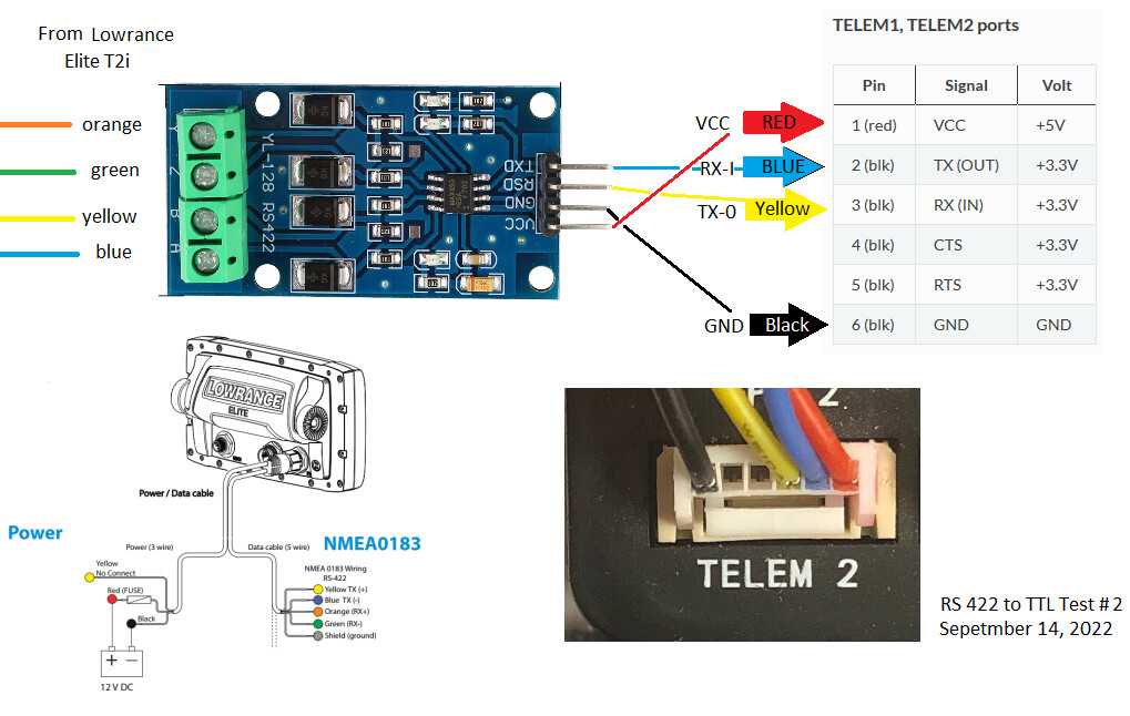
[SERIAL2_PROTOCOL] = 9 (Rangefinder)
[SERIAL2_BAUD] = 38 (38400 baud) (or whatever you set the Serial Output on the Elite to)
[RNGFND1_TYPE] = 17 (NMEA)
[RNGFND1_MIN_CM] = 13
[RNGFND1_MAX_CM] = 30000 (i.e. 300m).
[RNGFND1_ORIENT] = 25 (i.e. down) if mounted on a boat
You will have to set up the Serial Output on the Elite to set the serial sentence to just output Depth and make sure the baud rate is the same as your Mission Planner