Hello,
I am attempting to hover a fixed distance above the ground with the aid of a laser rangefinder, but I am seeing the copter hovering significantly lower than the commanded altitude.
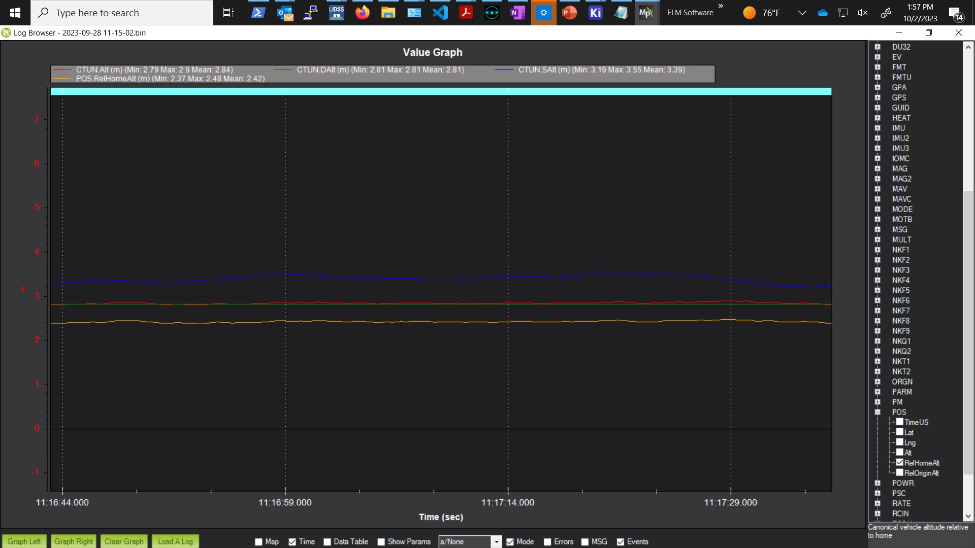
I takeoff and navigate to a location in Guided mode, and then I put the drone into Auto mode where I have written one waypoint which tells it to hover 5 meters above the ground. However instead of hovering 5 meters above the ground, it hovers at ~3.4 meters. At this point I question whether the rangefinder is influencing the altitude at all. What’s stranger still, is that even though the waypoint altitude is 5 meters, the CTUN.DAlt is only 2.81 meters. I also see that there is a 0.4 meter difference between RelHomeAlt and DAlt when the copter arms, but this doesn’t seem to be enough to explain the discrepancies I’m seeing. See screenshot of logfile attached.
Can anyone make sense of what I’m seeing here?
For reference, I’m using Copter 4.0.7 and I have the following params set:
WPNAV_RNGFND_USE = 1
TERRAIN_ENABLE = 0
TERRAIN_FOLLOW = 0
RNGFND1_GNDCLEAR = 33 (cm)
When I write my Auto waypoi
nt, the altitude reference frame is “Terrain”.