Hi,
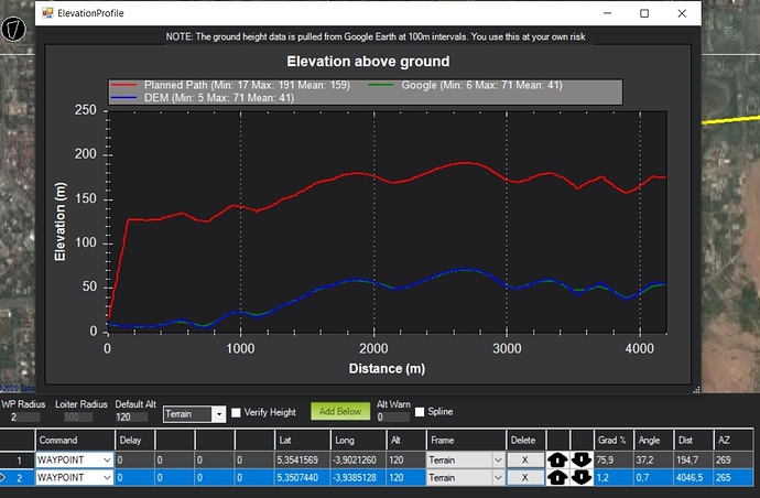
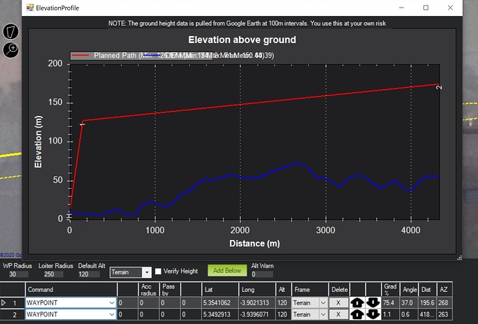
I am normally planning my flights using terrain and having verify height uncheck. Worked really well and was simple to use, but since 1.3.71 and 72 when I am doing elevation graph, it will show me change in height between two point and no following terrain. You will find an example bellow.
1.3.70, working well :
1.3.72, the same with 71 :
I saw major changes in 71 and 72, is this still in beta?
Thanks
Benjamin MATHON


