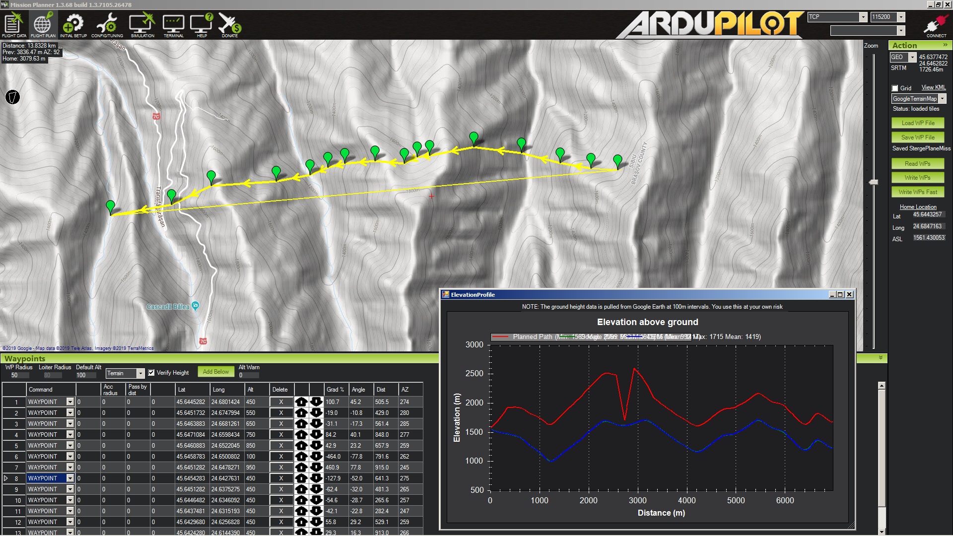
In Ardupilot Mission Planer, it is easy to plane, using the mouse and Google maps, the path of the plane in the horizontal plane. There is no need to introduce the Latitude and Longitude of each waypoint by hand. However, I do not find an easy way to change the altitude of the plane, for example, from following the terrain at say 450 meters for the entire trajectory to a custom altitude for each waypoint, set preferably by dragging the waypoint up or down on Elevation Profile.
Is it possible somehow to change the altitude of an waypoint as easily as its Lat and Long?
I know that if I want to change the altitude of all points together with the same height, I can use “Modify Alt” but what I want is to change the altitude of say 150 waypoints out of 400. For example, in some places I would like the plane should follow the terrain at an altitude of 200 meters and in other instances, when the plane crosses 500 - 600 m deep valleys I prefer the plane should not go down and then rise up, because it will waste energy. I know I can modify the altitude of each point in the table but again this is complicated because of so many points and besides this the window Elevation Profile has to be closed each time I make a change in Mission Planer. I can not keep Elevation Profile opened all the time and see how my altitude changes appear in the diagram.