i have a question just before Verify Height” checkbox in Mission planner
there’s button with these
Reiative
absolute
terrain
please explain
In MP dropbox,
“Relative” is the altitude relative from your home .
So if your home is at 400 mt from see level and you set the waypoint_1 at 100 meters the absolute altitude will be at 500 meters .
The altitude for waypoint will be showed as “100”
With “absolute” in the dropbox , the altitude will be showed for each waypoint as absolute so waypoint_1 will show “500”
“Terrain”, the altitude will be showed for each waypoint as realtive BUT teh flight path will consider the terrain profile .
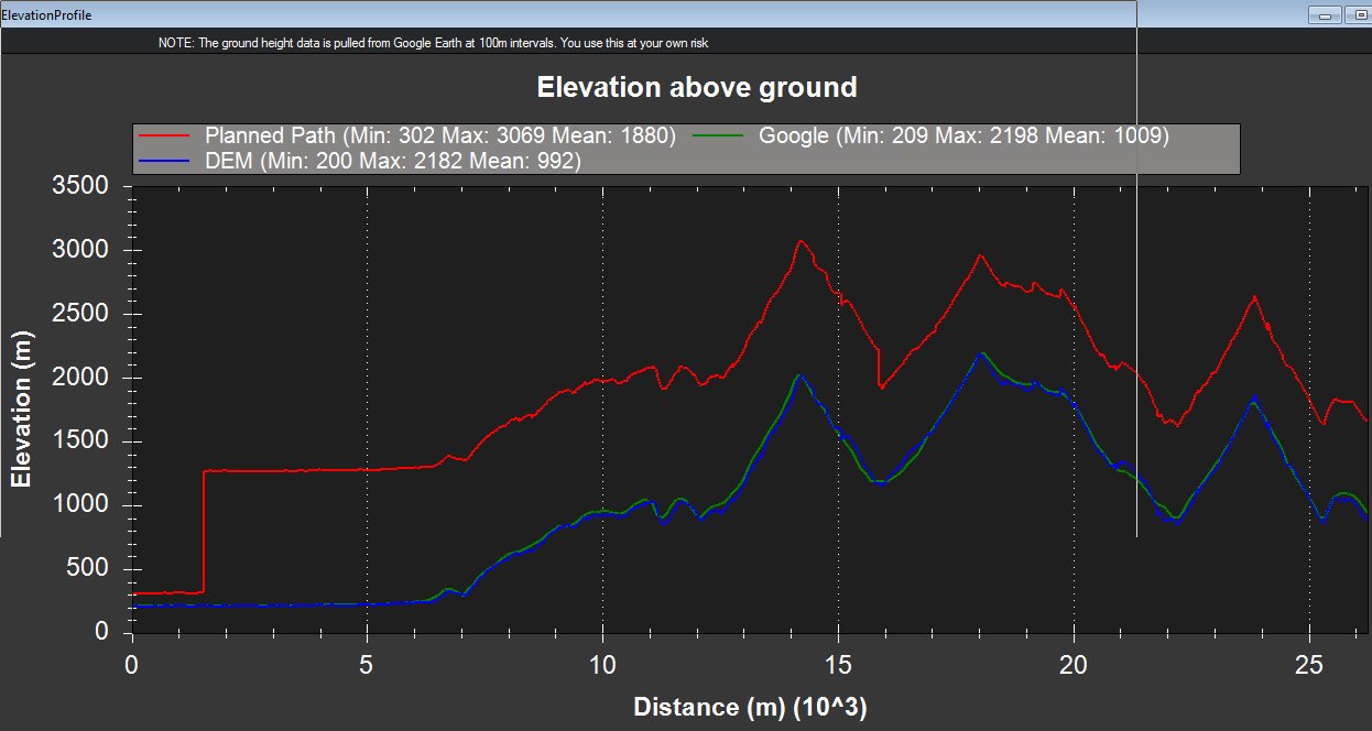
Look at these images caputred from Mission Planner Map menu , elevation profile.
This is with “relative” set :

The plane WILL CRASH in the hills
This is with “Terrain” set , 100 meters above waypoints AND terrain profile (not really the same path, it is just an example ):
2 Likes
Thank you very much for the reply
so if i set
Terrain
default Alt 120
verify height
it will stay 120 above ground ?
is there anything else need to be running ?
You have to enable terrain folllowing in the parameters. once you have done that your drone will recieve terrain data a few seconds after you upload that flight plan, but it wont upload the data if your drone doesn’t have a gps signal.
Sir, Thanks very much for this explanation could you please describe in detail regarding elevation planning.
hello! what source of terrain altitudes does MP use?