Hello !
I am following these tutorials in order to use a Super Beacon from Marvelmind as GPS:
https://ardupilot.org/copter/docs/common-marvelmind.html
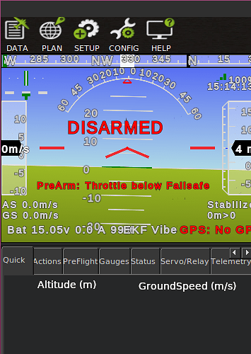
And I am stuck at Set BCN_ORIENT_YAW. I don’t understand how to read the vehicle’s heading from the HUD.
I’m guessing that the HUD is Mission Planner in my case and the value I need is Yaw(deg) which I can take from here:
But this info is here only when having the drone connected via USB to the PC that runs Mission Planner.
If I stand at the origin holding the vehicle so that it’s nose points towards the second beacon the drone won’t be connected to the PC and I won’t have any info on the HUD, because the origin beacon is not near my PC and it will never be.
Also, there is another way of setting BCN_ORIENT_YAW in one of Marvelmind’s manuals: https://marvelmind.com/pics/marvelmind_navigation_system_manual.pdf
At 9.11. Settings to obtain the correct north direction it says that I can somehow take BCN_ORIENT_YAW as the angle between the Y axis and the real north (while having the lowest address as the origin), measured manually by me in some way or another.
What do you think ?
