Hello all,
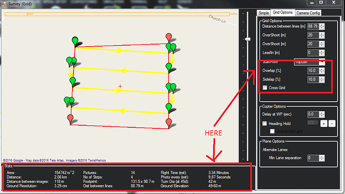
I am looking for a way to find out the Ground Resolution and Overlap/Sidelap of a plan I have created which was NOT generated through AUTOWP (Survey Grid), but has instead been manually plotted. Is it possible to generate this information?
If not, is there anyway to view the same information for an AUTOWP (Survey Grid) after it has been created? For example: I “Accept” and create a plan, and then wish to re-access the information shown at the bottom of that window. Is it gone forever once the plan is created?
And finally, if neither of these are possible, does anyone have any other solutions to work out the GSD and overlap/sidelap of a plan after its completion?
Screenie attached:
Thanks for helping,
Charis
