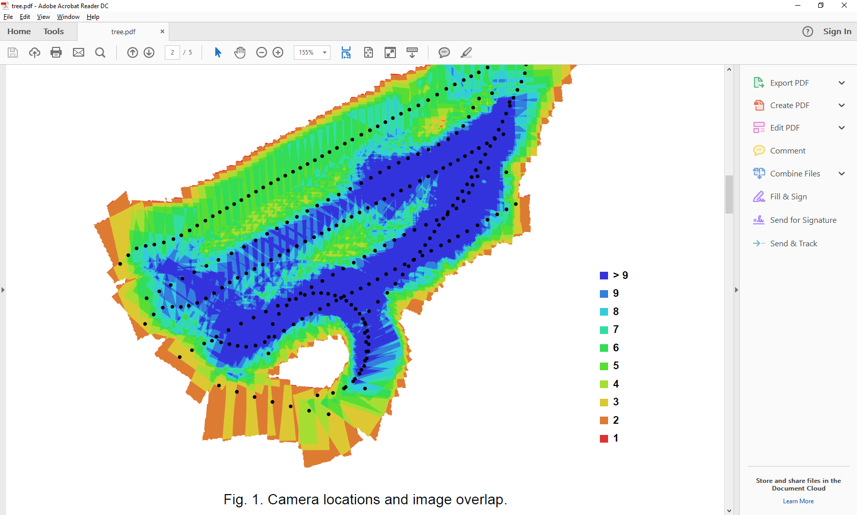
Recently I found out that overlap (both side/front) in MP and Tower using the same camera, altitude and overlap settings is different. The difference is around a factor 2. So MP creates 2x more images in 75/75 overlap grid than Tower. I tested this on a 200 hectare project. With Tower I got cca 3500 x 24MP images. With MP I got around 7000 images. There were 15 missions in both scerarios and mission overlap was around 10%.
The problem is that there is no independent verification tool that would verify the real mission overlap after the data is captured and map created. Any photogrammetry SW I was using did not say what is the final overlap. It says if overlap is good or not but it doesn’t say anything about how many % overlap it really is. From my experience MP creates too many images, about twice more than Tower.
Well this is very uncertain answer… I would say I need some more accurate way how to validate the overlap from any mission planning tool…perhaps I will request such feature with some photogrammetry SW vendor…
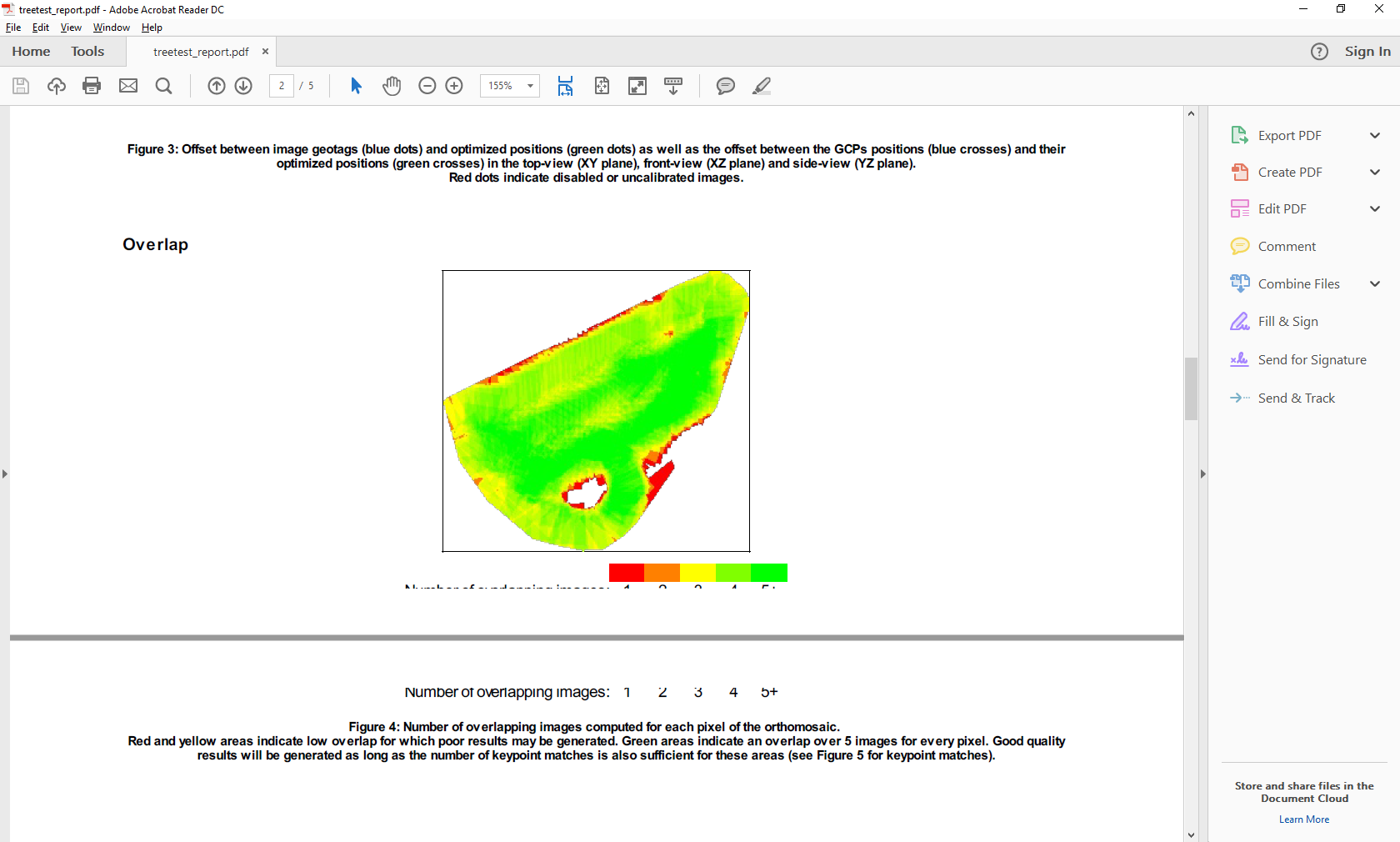
Oh wait… so it means that a value 7 means 70% for Photoscan and value 4 means the same in Pix4d right ? Well that could make some sense than… OK I will take this as validation tool then… But in any case MP has this bug that it actually creates higher overlap than set up in the planning step…
you are asking to compare the overlap between 2 images. no package is designed to do this. as it can be inspected manually via viewing or the other option is to calc the information yourself based on you camera and come to your own answer.
If you want to do it yourself, Michael’s suggestion of comparing to photos is completely valid. I’m not sure why you feel this is not accurate. You should know the Gsd of your image, the size of each pixel. Overlay two images in a program like Paint.net that let’s you use layers, or a gis program like Qgis that let’s you georeference two images together. Paint.net would be more straightforward. All you need to do is verify the overlap of a few images over the survey area to know how accurate the planned overlap is.
the real key here is you must want to verify the spacing mp is producing. if i where you i would go back to the basic maths behind the problem, to verify for yourself. then you can come to your own answer. i dont know what tower does. so cannot comment on that.