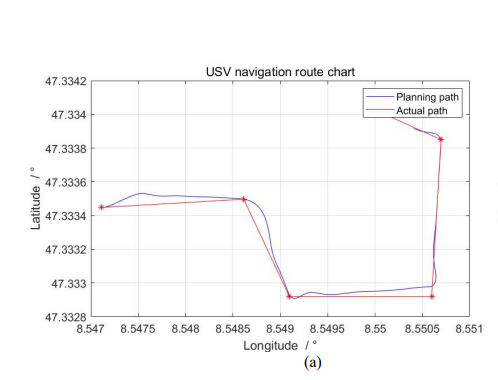
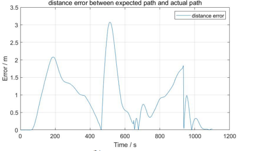
I want to plot a graph of waypoint and Acutal path of UAV on the same graph with Latitutes and logitutes as y and x axis. How do I get the data from the mission planner app to plot this type of graph? Reference pic of the graphs I want to plot are attached here.