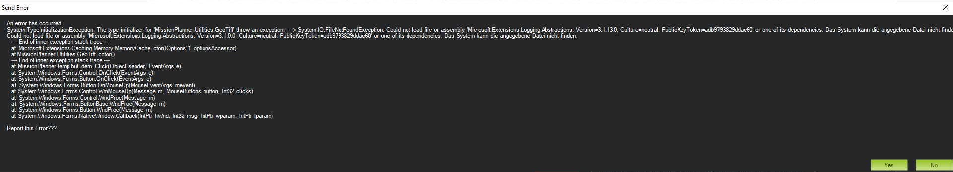
My MP updated the other day and now I no longer seem to be able to use imported GEOTIFF maps.
In the PLAN page, if you had a tiff for the area saved in the Program Data > Mission Planner > srtm folder then the loaded elevation would change from SRTM to GEOTIFF (GEO?) when your mouse was hovered over the area.
I’ve attached a link to one of my Geotiffs that should work.
These are always created using 1 or 5m LIDAR data from the Australian Government geospatial service. They are then re-projected in QGIS3 to the correct format. We have to be pretty precise for what we are doing.
Done. Just updated to the Beta 1.3.75.1 build 1.3.7892.20677 and the issue is resolved. Seeing GeoTiff data again in the PLAN screen.
Is this Beta stable enough to test in the field? I’m supposed to depart for a mission tomorrow and wondering if I need to roll back to 1.3.74 again.
MP is only a backup GCS running on a Herelink wifi connection for this aircraft so not that critical.
 )
)