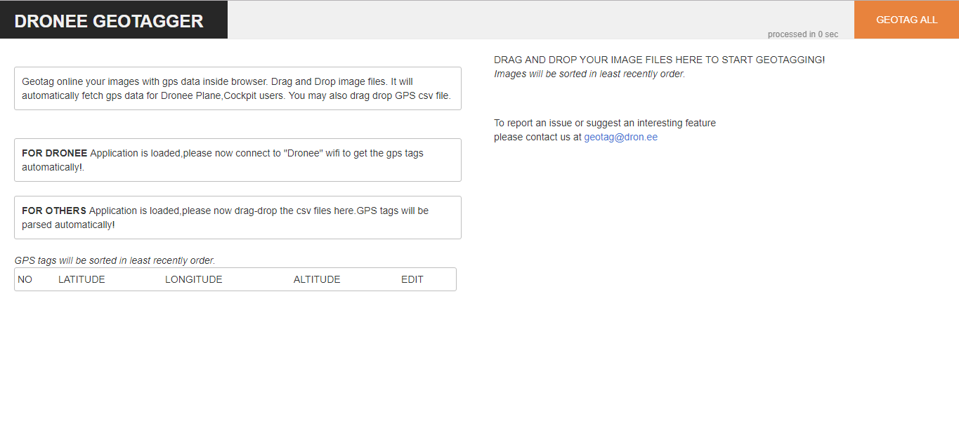
In-Browser super simple to use Geotagger.
Open DroneeGeotagger
if you use Dronee Plane:
You need to connect to Dronee Plane wifi “Dronee” on a computer and dronee geotagger automatically will take GPS coordinates from the drone and will appear on DroneeGeotagger page. Only need to take images from camera, drag and drop into the browser. Then press " Geotag all" button. It will automatically geotag images with coordinates with least order and will save geotagged images in desktop.
If you use any other drone:
1.Drag and drop CSV file (Dronee Geotagger automatically will fill GPS coordinates in columns)
2.then drag and drop image files
- Then press " Geotag all" button. It will automatically geotag images with coordinates with least order.