I am trying to graph the the CMD altitude vs the actual altitude. However, the CMD doesn’t match the actual. I am plotting GPS ALT vs CMD ALT. Am I missing something or shouldn’t they both track each other? I am using mission planner log reviewer for plotting.
because they are not the same things.
you plan in relative altitude. ie your home alt is 0
whereas the gps alt will be MSL. ie your altitude above mean sea level.
1 Like
Is there anything in the dataflash or the tlog files that has command altitude that will match my gps?
only if you add your home altitude to the point, they will be close to matching.
1 Like
Could you elaborate on that? what do you mean add your home altitude to the point?
So if I did the above my CMD ALT should match my gps alt?
given you havnt posted any logs etc.
can you please post details of the issue.
ie samples of the data where you are seeing the issue. so I can reply within your sample set.
dataflash log shows relative altitudes
the gps message shows above sea level values
so to make the mission = gps. you needs to get your home altitude + mission alt = gps altitude.
1 Like
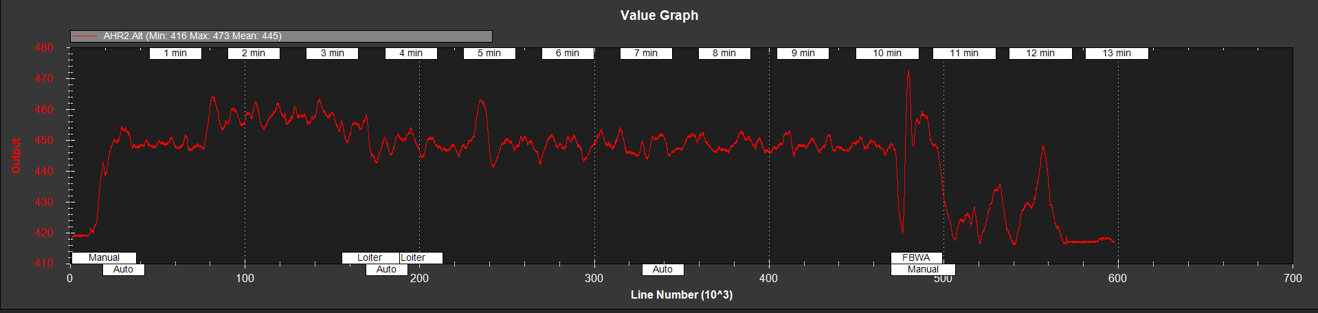
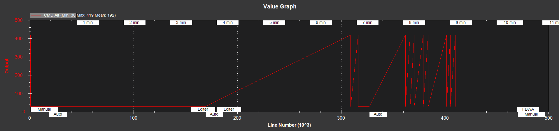
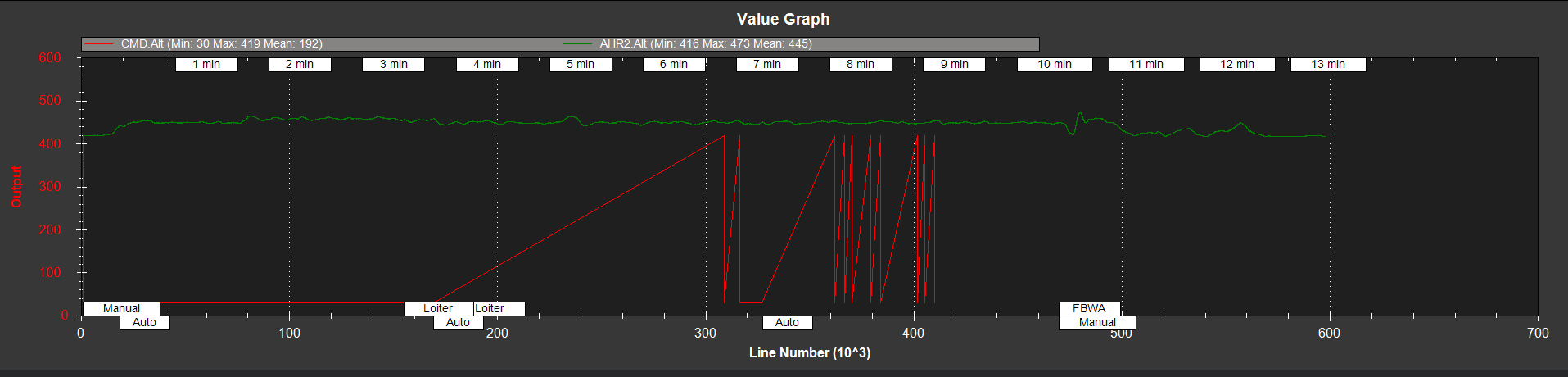
Here are 3 plots. The first is my actual altitude, the 2nd is my CMD altitude and the last one is both together. Notice how much different they are? also the CMD altitude doesn’t even have values beyond 430ish, where we clearly had an Altitude change at around 480.
Here is out data file:
https://drive.google.com/open?id=0B5KYENcqH1QfeHVVdE1WcU5fUms
Sorry I didn’t know where else to upload it