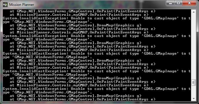
I tried the feature with my own imagery and want to share/discuss my findings:
I used QGIS to convert my Imagery to WGS84. As it turns out: Data in UTM System “works” also. Data is in Int16 format. LZW compressed data is working as well. In all cases 4 Channels.
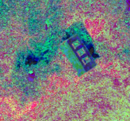
I noticed a strange color shift:
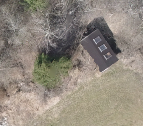
Have a look at the original file:
And the Mission Planner equivalent:
The imagery is only visible at and below fourth “nearest” zoom level. Can we change that?
Changing the GSD (Pixel Size) does not change the visible outcome shown under point 2.
I’m on my way to the ArduPilot unconference at the moment, so wont have a chance to look at this for over a week, or so. the zoom level is defined by the GSD, and was by design. as for the color shift, it will have something to do with the format, but I cant get that info atm either.