I’ve been learning how to fly photo mapping missions.
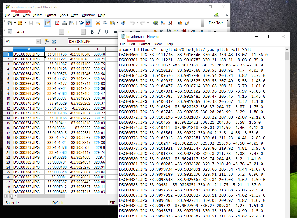
I use the Mission Planner geotag my image files.
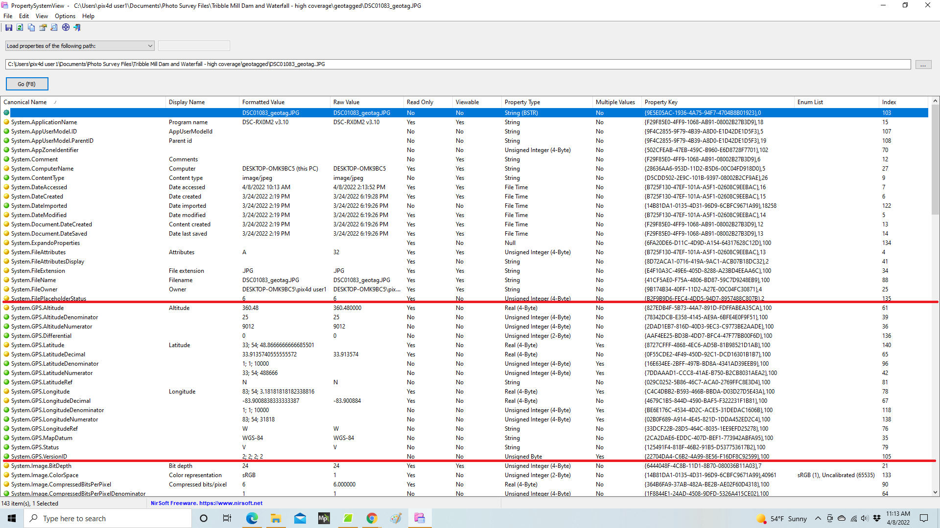
The geotag files that are created when the EXIF is updated with the GPS data have information that does not appear in the EXIF. In particular - heading, pitch and roll. I don’t know if EXIF has fields for this data.
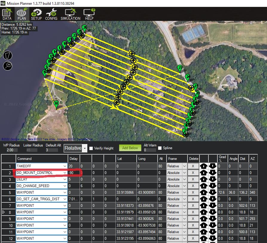
My camera gimbal is an Alexmos using Mavlink. I start the mission with a do_mount_control command to set the gimbal pitch at -90. (to face down)
Do the pitch, roll and heading data recorded in the location files reflect the pitch and roll of the copter - or does the Alexmos controller communicate back to the autopilot so that the recorded pitch, roll and heading record the camera’s orientation?
I’ve included screen shots that display the mission, the file contents of the CSV and TXT files output by Mission Planner during the geotagging process, and the EXIF data displayed by the PropertyView app.
The location.txt file has the headings of the fields. The last column is “SAlt” - and it’s all zero data. It would be interesting to know what “SAlt” means - and why this data is zeros.