My English is not very good, maybe there are some grammar and word errors, if there is something wrong, please tell me. We are in urgent need of technical support. If anyone has good ideas or solutions, please contact my personal email: chenwang80642@gmail.com
At present, we need to make a boat, which requires autopilot, water depth measurement, and obstacle avoidance. We intend to use a mission planner to plan routes for autonomous driving.
What we plan to use are:
pixhawk controller
3DR Digital Radio
We are also considering using CUAV’s 4G digital link for remote driving control
Radio control using Graupner MZ24
Obstacle avoidance scheme using millimeter wave radar or lidar
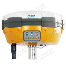
RTK uses a commercial mass-produced GNSS system, which looks like a big mushroom and looks bulky. It was previously used for land surveying.
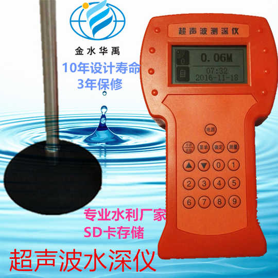
We want to use the cheapest single-beam handheld sounder.
Photos of GNSS and depth sounder are here:
GNSS
and depth sounder
The hull is still in the design stage. In order to reduce the impact of waterweeds and garbage, we use a dual-pump spray type and differential steering. It is not important. What really stumped us are the following issues:
First: We have special requirements. We want to connect our depth sounder and GNSS system to perform interval measurement.
That is: we install the GNSS system and the sounder system on the ship and then plan the route for the mission area in the mission planner and set the measurement interval. The triggering of the GNSS system and the sounding system is like triggering a shutter in drone mapping The GNSS data and the sounder data are combined into one file. If the sounder scan is continuous, we can only trigger the GNSS system, but also record the water depth data at this location when the system is triggered. We cannot use
Second: Obstacle avoidance. When planning routes, the water maps we see in the mission planner are different from the actual water maps, which may cause the unmanned ship to run aground when moving along the planned route. Is there any way to avoid shore and water obstacles in automatic mode? We hope to solve this problem by using lidar in the community. Is this possible? We don’t have much technical accumulation in this field, so this is really a big problem.
If someone can help us, we will be very grateful. If someone can help us solve these two problems, we can continue our work and continuously update our manufacturing progress.
I also hope that someone can recommend a more reliable sonar to us. We require a sonar measurement depth of 150 meters. It can be used in fresh water and a single beam. The price can be as low as possible. Accuracy can reach 0.3% H (H is the depth measurement value)
Thanks everyone!