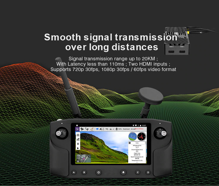
At the Ardupilot Developer Conference held in Suzhou, Hex Company released their new 2018 product- the Herelink DigitalIntegrated Remote Control Device.What impressed most people was that an imaging company that was also present at the time expressed disbelief that the number of pictures released by Hex can be compatible with the parameters of the remote control device.They didn’t believe the 20KM high-definition map transmission distance, the price of 5,500 yuan and that it does not curently exist in the market. When I also bought Hex’s integrated control device the first time, it took a month for me to receive the product.However, we should understand that it is not always easy to make a hardware. This price which includes 20KM graphics, remote control, and a digital transmission link is a little bit suprisng though. I am also curious about what this device can do, and I promise more articles with detailed analysis on it in the future.
Please continue to be with us on our social media accounts(youtube, diydrones, ardupilot forum), for more updates. And our shop on amazon will be opened soon.
Features:
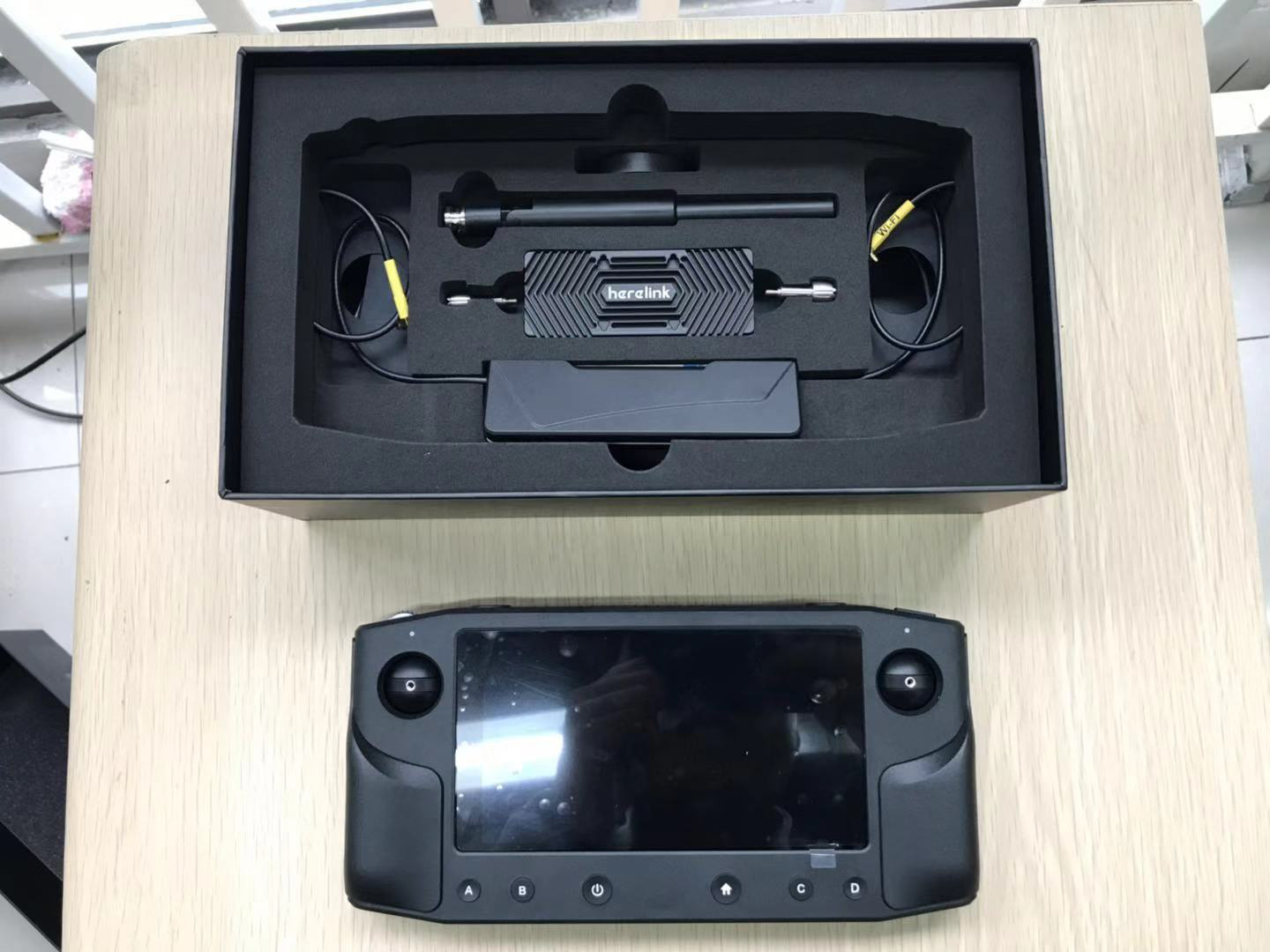
the transmission end of the image is relatively light,about 95g which is similar to the weight of a flight control;
it can operate QGC ground station, Ardupilot and PX4 firmwares;
it contains image transmision links, digital connections, and remote control links;
it runs Android 7.1.
So far, from the hardware point of view, the product can be summarized as: light and small ,portable, excellent workmanship with no major defects.
But if there is no HMID image to transmit the signal, it will not be possible to project HD real-time video on the display(screen). Integrated control comes with WIFI module and it was said during the exposition that the upgraded software can support WIFI video output, but the WIFI output image will be slower. It should be difficult to project a high-definition image onto a larger display.
Here are the basic tests for software:
The most important indicator of the picture transmission is the delay, which results in delay in the coding of image acquisition, image transmission, image decoding and display.We tested the delay of about 200MS in the case of relatively still images which according to the producer, the lowest is 110MS.We tested indoors between 200MS and 280MS and this parameter was acceptable.
We haven’t gone outside yet, but we suspect if the outdoor image changes drastically and distance interference problems occur, the delay may increase.
Comprehensive evaluation of indoor test: The basic image transmission function is up to standard and cost-effective.
The software uses a modified version of the QGC ground station:
When we tested the Rover firmware using Ardupilot, there was still a gap between its use and the relatively complete MissionPlanner ground station.However, with regards to the Android hand held ground station, as long as it has a complete route plan, the image is shown and some basic instruction operations are acceptable.The QGC ground station could not be finished, using the full interface.
Here is the test video:

The following is the description of the ground pull test:
At present, we have not yet conducted an aerial pull test, and the remote control distance of the test ground map is about 609 meters.Because considering that it is not an air pull test (it is completely a ground test on the unmanned vehicle), this data is also acceptable. Generally, when such a picture transmission device is not visible on the ground, the transmission distance could not be really far away unless the antenna is high or the power is further increased.
In fact, for a picture transmission, the significance of the ground test is not very big, because the ground attenuation of the picture transmission was very serious. We are only testing the range that can be covered by this image on the unmanned vehicle.
On this ground station, for different distances, some parameters can be set, which may further increase the transmission distance. However we did not do it in this test.
To sum up:
1 It has an Open source integrated control (quasi-technical level)
2 The cost performance is relatively high; picture transmission, digital transmission, and remote control link are integrated.
3 Built-in QGC ground station has detailed needs to be optimized, and its own Android system also has more room for optimization .
4 Hardware HDMI high-definition video stream output is not supported, and 5G WIFI video stream may be supported in the future.
5 Currently, it does not support Google China Map but it supports Microsoft Bing Map and Google Maps (not supported by China).The defects of Microsoft map update makes it very slow, causing great inconvenience to planning the route.
We haven’t done the air pull test yet. In general, although we think the price/performance ratio is still very high, we believe its alright for Hex to launch such a product, which constitute a big step forward for the open source unmanned system!
At the same time, I believe that this integrated control is the trend for the future , and will gradually replace the traditional remote control devices. The three links of the picture transmission, digital transmission and remote control are integrated, and the benefits are self-evident.